Examine geographic patterns, relationships, and trends using GIS techniques and statistical methods. Spatial analysis helps solve complex spatial problems by analyzing location-based data for applications such as urban planning, environmental management, and transportation modeling.
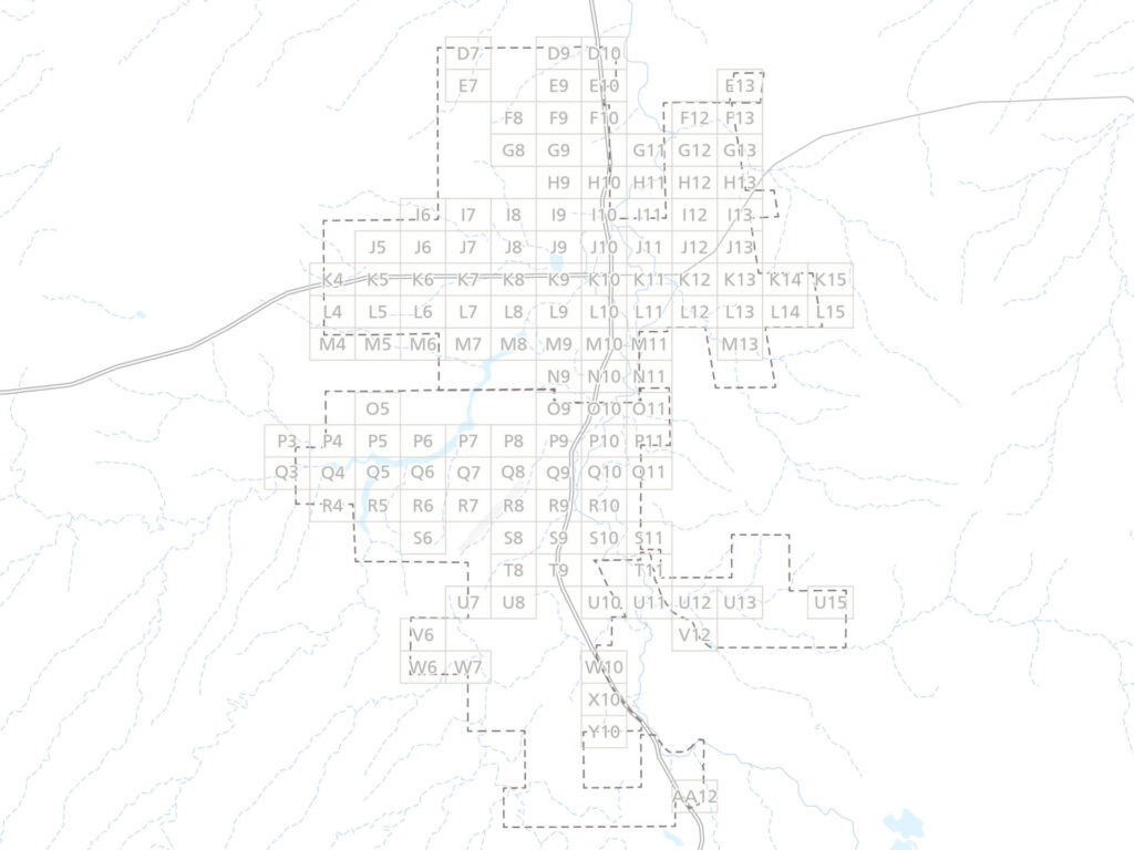
- Emergency services map book for response planning

- Spatial regression of traffic crashes in Austin
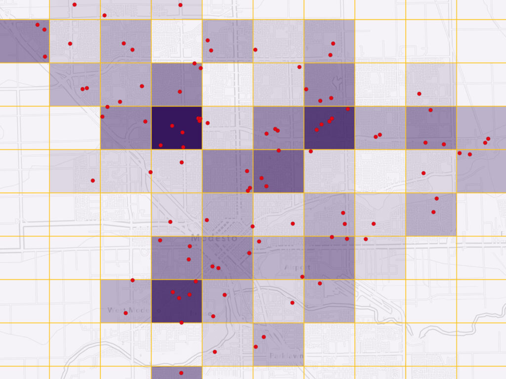
- Point pattern analysis of residential fires in Modesto
- Siting mobile library stops in rural West Virginia
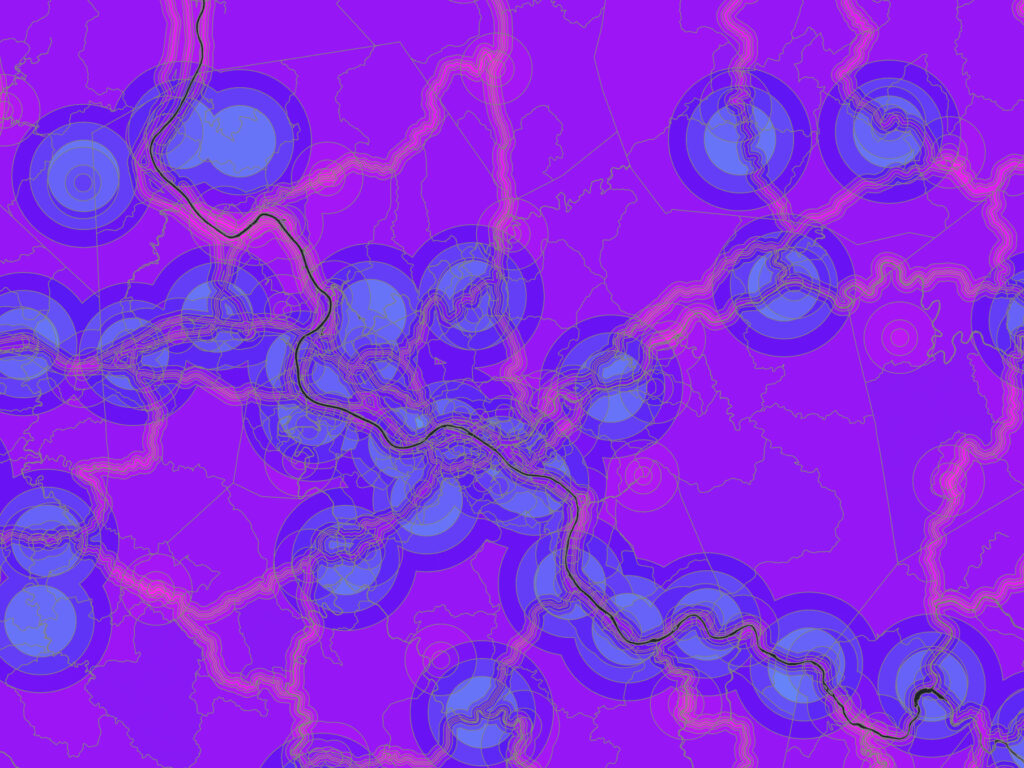
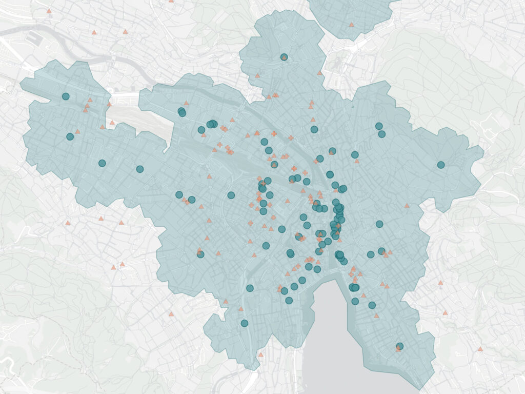
- Zurich pedestrian accessibility
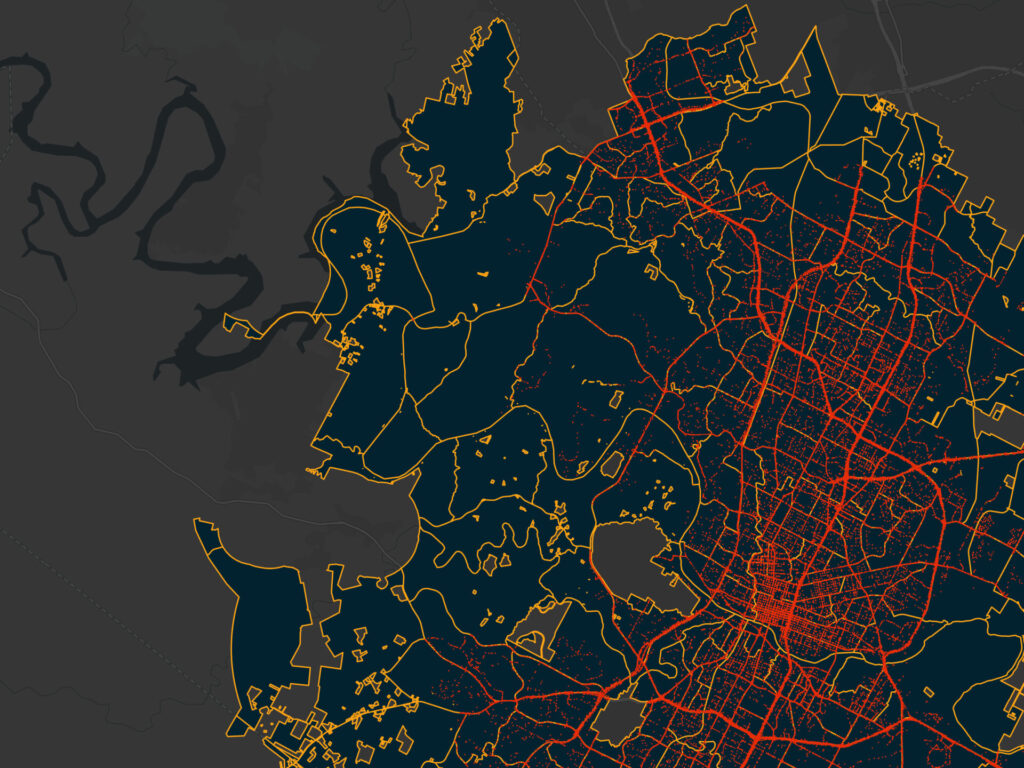
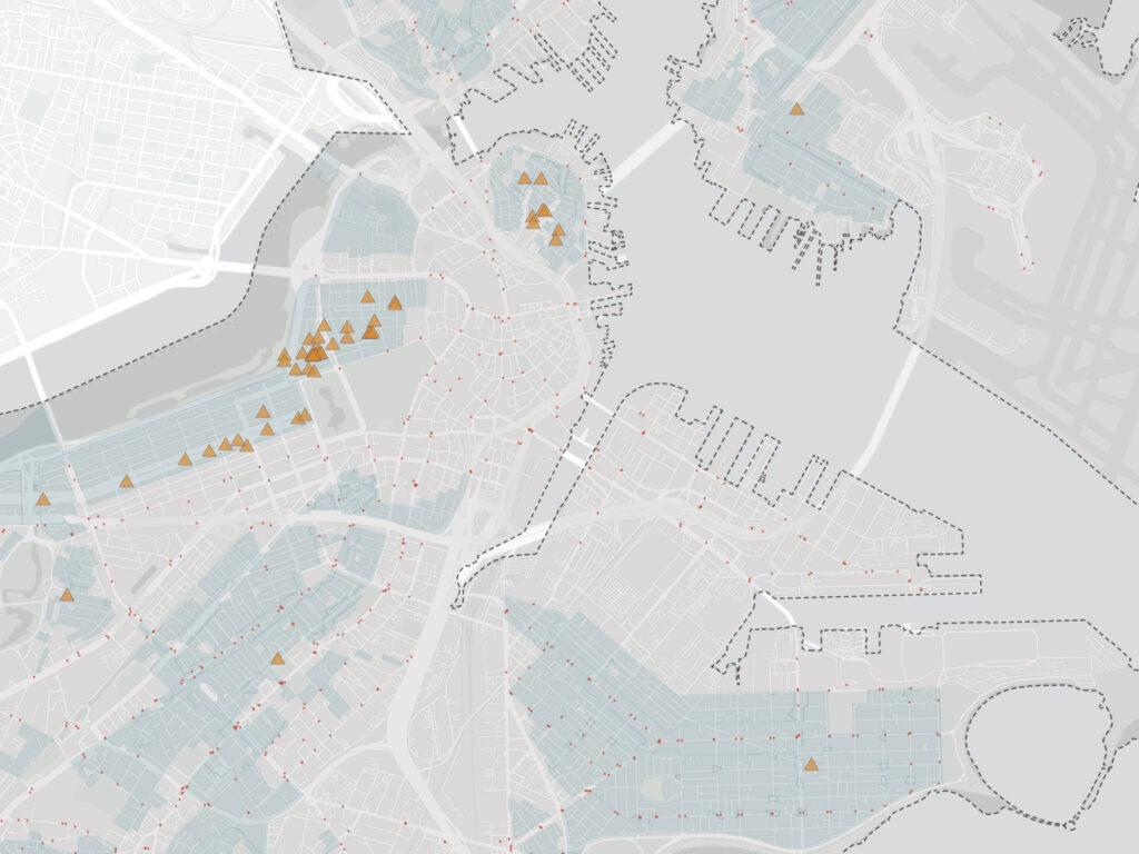
- Historic sites and urban accessibility in Boston
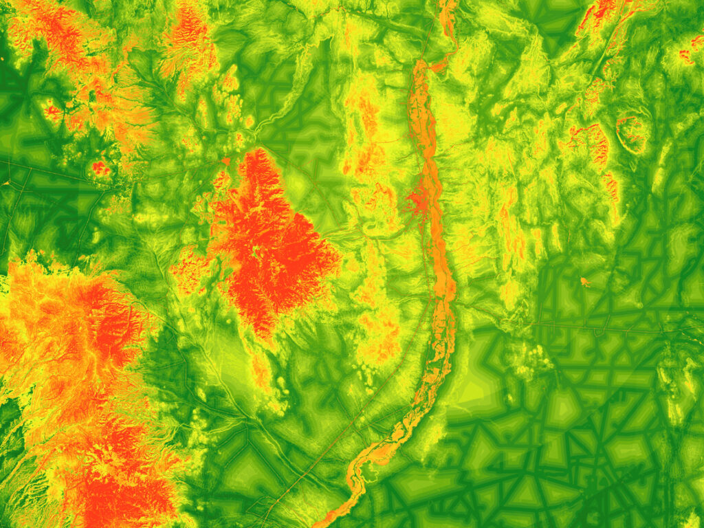
- Siting a raptor rehabilitation center in central New Mexico
- Interpolation of fine particulate matter across the U.S.
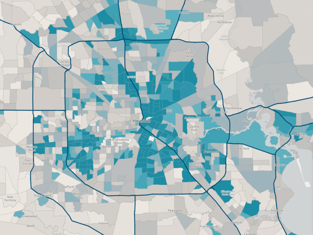
- Houston evacuation routes
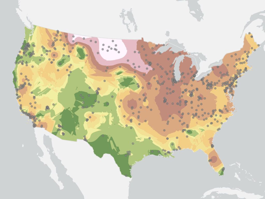
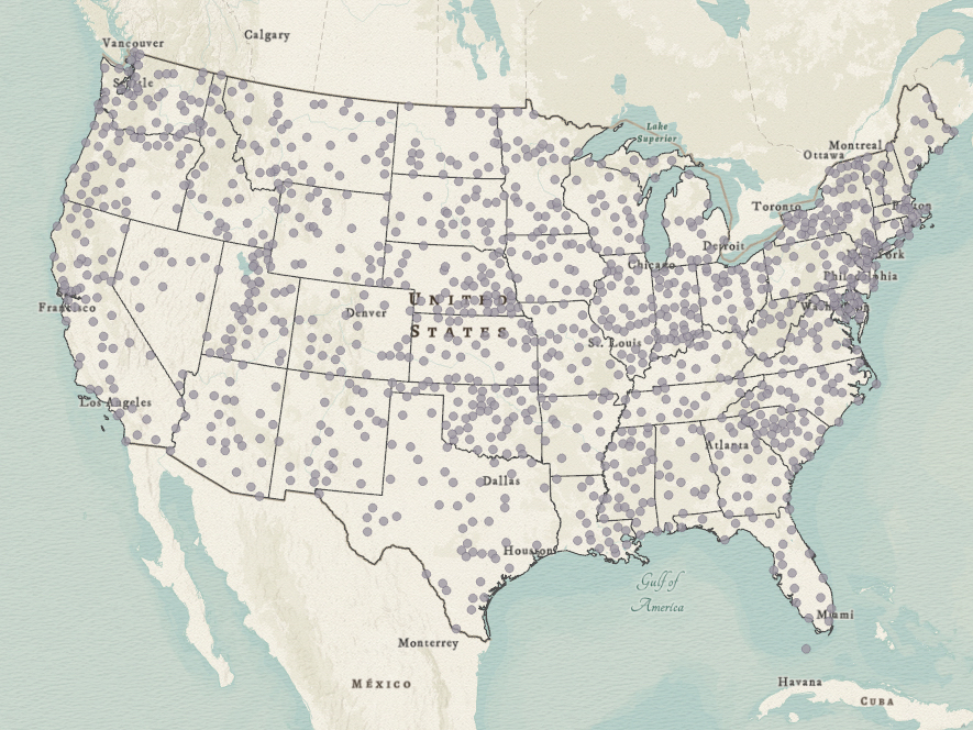
- United States weather stations

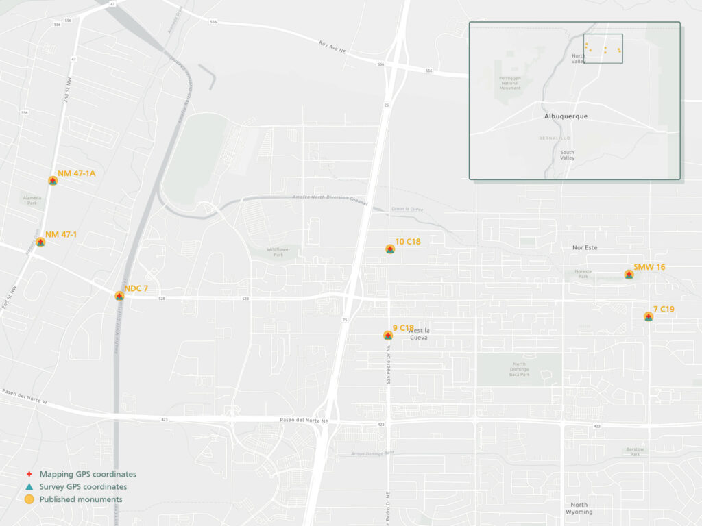
- Mapping vs. survey grade GPS receivers