A raptor rehabilitation center presents an unusual siting problem. It must be accessible to staff, volunteers, and animal transport while remaining removed from the noise and disturbance of dense development. It also needs relatively level terrain, open habitat, and enough contiguous space for treatment facilities, specialized enclosures, and flight conditioning.
This project translated those competing needs into a suitability model for six counties in central New Mexico: Bernalillo, Sandoval, Santa Fe, Socorro, Torrance, and Valencia.
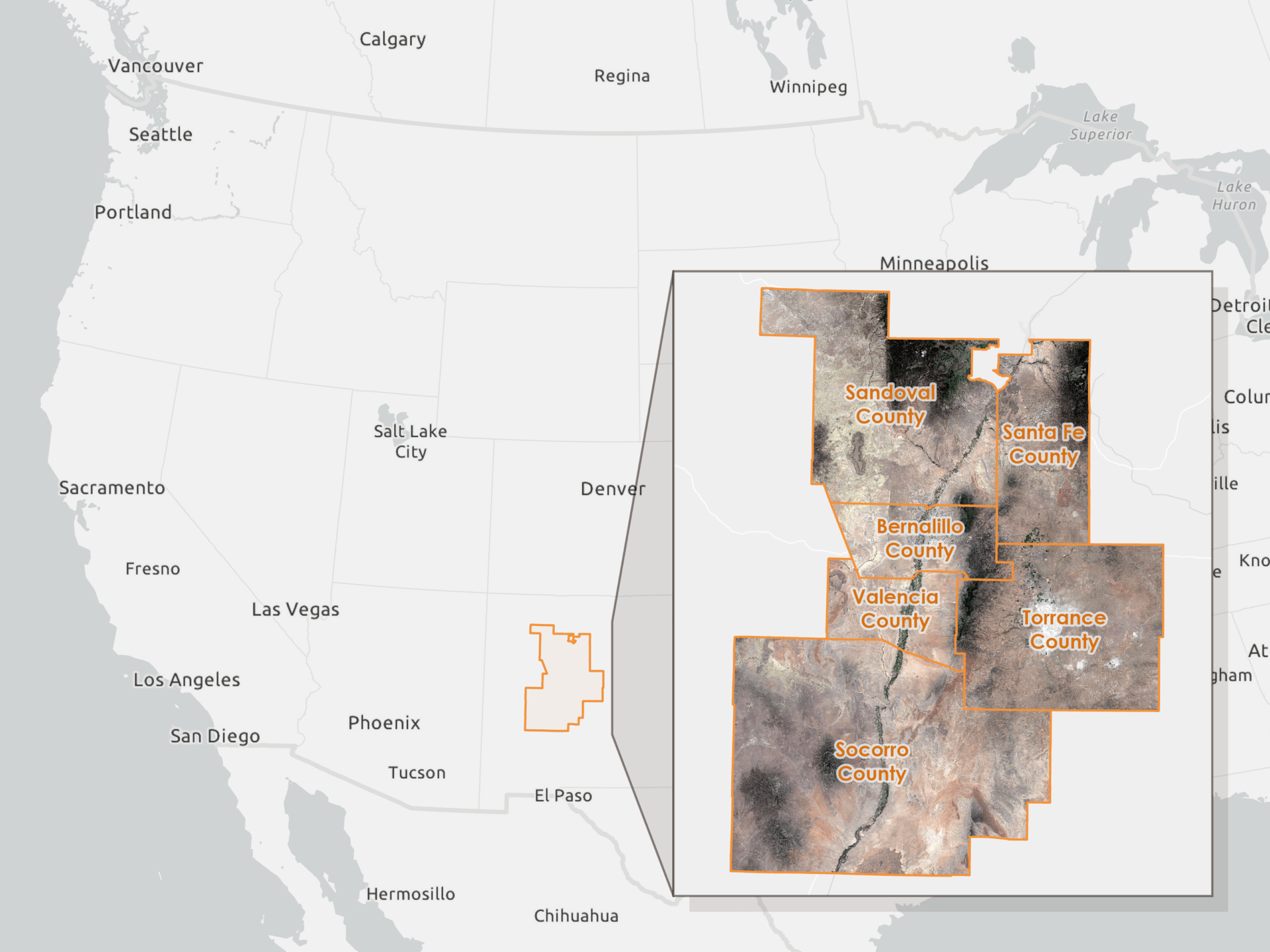
Several organizations already rescue and rehabilitate injured raptors and other wildlife across New Mexico. This analysis explored where a purpose-built central facility might complement that existing network by providing space for clinical treatment, quarantine, specialized enclosures, physical conditioning, and preparation for release.

Defining suitability
Selecting a location required balancing ecological conditions, operational access, and separation from concentrated development. Five spatial criteria were used to represent those needs.
| Criterion | Purpose | Data source |
|---|---|---|
| Minimal slope | Favor relatively level terrain for construction and site access | USGS 3DEP 10-meter elevation data |
| Open habitat | Favor grassland and shrubland while avoiding developed land, water, wetlands, and dense forest | USA Legacy NLCD Land Cover |
| Proximity to roads | Maintain practical access for staff, volunteers, and animal transport | Census TIGER/Line roads |
| Distance from urban areas | Reduce exposure to concentrated development and human disturbance | Census TIGER/Line urban areas |
| Proximity to protected areas | Give modest preference to areas near land managed for conservation | PAD-US Protection Status |
Proximity to protected lands was treated as a modest contextual preference rather than a strict requirement. The model also used 20 contiguous acres as a minimum planning assumption, providing space for rehabilitation infrastructure, flight conditioning, and possible future expansion.
Building the suitability model
Sentinel-2 imagery provided geographic and ecological context for the study-area map, while elevation data accessed through Google Earth Engine supported the slope criterion. The remaining criteria were prepared in ArcGIS Pro. All model inputs were clipped to the six-county study area, projected to NAD 1983 UTM Zone 13N, and converted to a common 30-meter raster resolution.
The raster-processing sequence was organized in ModelBuilder so the same transformations, scoring rules, and filtering steps could be applied consistently across the five criteria. The broader modeling framework was adapted from an Esri suitability tutorial and rebuilt around the needs of a raptor rehabilitation center.
The prepared inputs produced five criteria rasters:
- Slope
- Land cover
- Distance to roads
- Distance from urban areas
- Proximity to protected lands
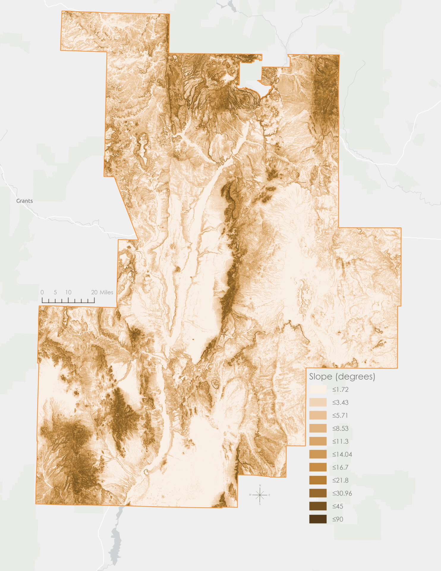
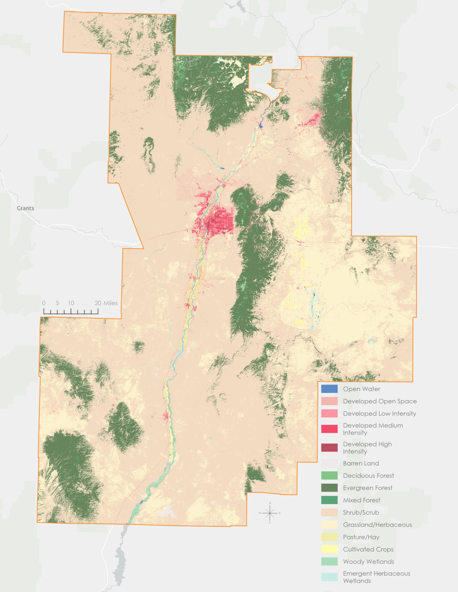
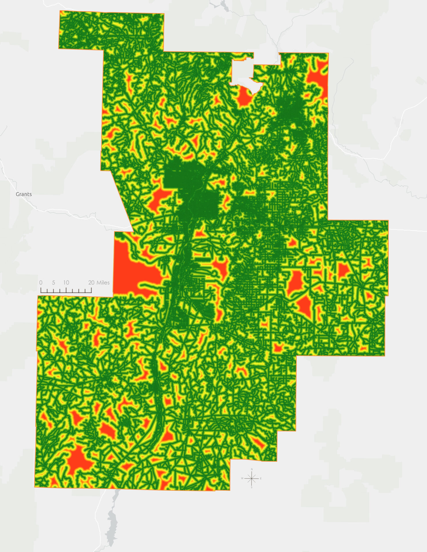
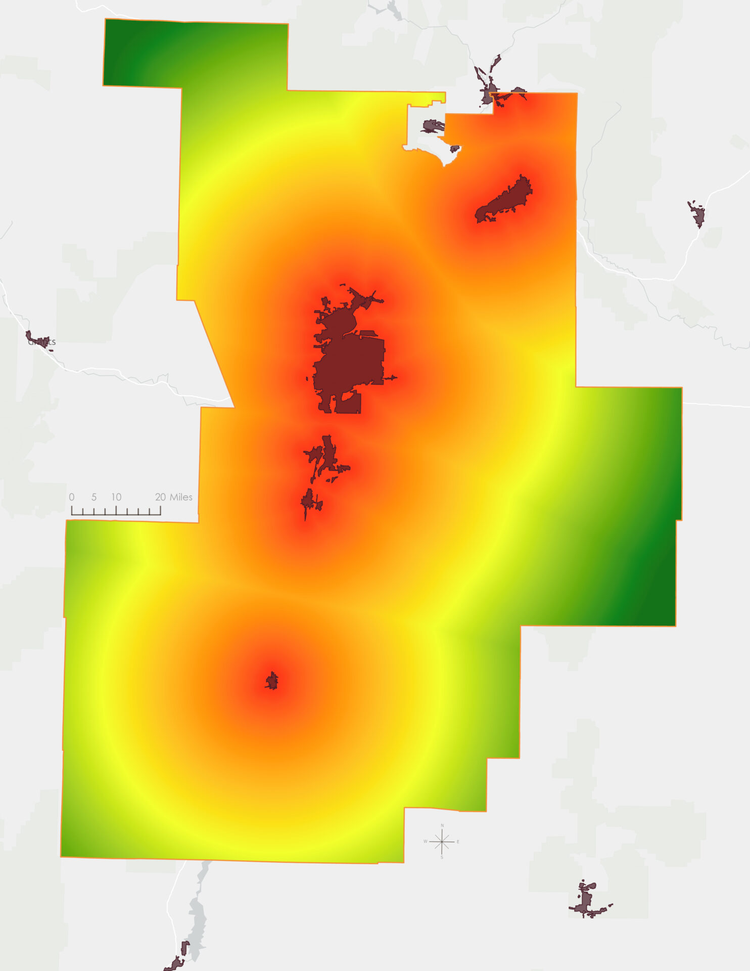
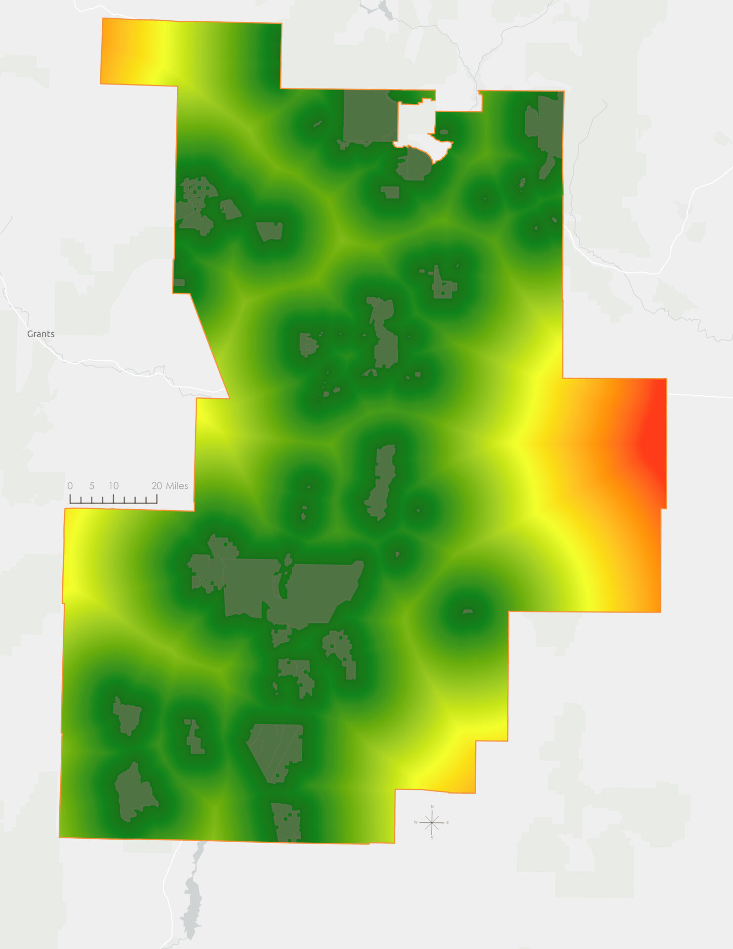
Because the source layers represented different kinds of information, their original values could not be combined directly. Each criterion was standardized to a common suitability scale from 1 to 10, with 10 representing the most preferred conditions.
Lower slopes and open habitats such as grassland and shrubland received higher scores. Road access and distance from urban areas were balanced to favor locations that remained reachable without being concentrated within developed areas. Proximity to protected lands received more modest influence as a conservation-alignment factor.
The standardized rasters were then combined through a weighted overlay. Land cover and slope received the greatest influence because they most directly represented habitat conditions and the physical suitability of the land.

From suitability scores to candidate areas
A high score in an individual raster cell does not necessarily represent a practical site. The model therefore included additional steps to favor broader areas of consistently suitable land.
Focal Statistics calculated the mean suitability score within a circular neighborhood with a 30-cell radius. At the model’s 30-meter resolution, that neighborhood extended approximately 900 meters from each cell. This reduced the influence of isolated high-scoring cells and emphasized larger concentrations of favorable conditions.
Areas with a neighborhood mean of 9 or higher were retained. The Region Group tool then identified contiguous high-scoring regions, which were filtered to remove areas smaller than the 20-acre planning threshold.
After those steps, three candidate areas remained.

Within the assumptions of the model, these three areas best matched the ecological, physical, and access criteria used in the analysis.
From modeled suitability to site feasibility
The model identified areas that best matched the selected ecological, physical, and access criteria. These results should be understood as screening priorities rather than development recommendations. Different criteria, weights, scoring rules, or thresholds could change which locations rise to the top.
A full feasibility study would need to examine parcel ownership, zoning, utilities, road access, acquisition constraints, and conditions observed in the field. Consultation with wildlife rehabilitation professionals would also be essential for determining whether the model’s assumptions reflect the operational needs of an actual facility.
The value of the model is not that it selects a final site automatically. It makes the siting priorities explicit, applies them consistently across a large region, and narrows the search to a manageable set of places for closer investigation.
Citations
Esri. (2024). United States county boundaries [Feature layer]. ArcGIS Living Atlas of the World. https://www.arcgis.com/home/item.html?id=36a7fa832aea4b7e8266a8d983afa4ac
European Space Agency. (n.d.). Harmonized Sentinel-2 MSI: MultiSpectral Instrument, Level-2A surface reflectance [Data set]. Google Earth Engine Data Catalog. https://developers.google.com/earth-engine/datasets/catalog/COPERNICUS_S2_SR_HARMONIZED
Johnston, K., & Allen, T. (n.d.). Site a sustainable shrimp farm [Tutorial]. Esri. https://learn.arcgis.com/en/projects/site-a-sustainable-shrimp-farm/
Llewellyn, P. J., & Brain, P. F. (1984). Guidelines for the rehabilitation of injured raptors. International Zoo Yearbook, 23(1), 121–125. https://doi.org/10.1111/j.1748-1090.1984.tb03016.x
Multi-Resolution Land Characteristics Consortium. (2023). USA Legacy NLCD Land Cover [Image service]. ArcGIS Living Atlas of the World. https://www.arcgis.com/home/item.html?id=3ccf118ed80748909eb85c6d262b426f
U.S. Census Bureau. (2024). 2024 TIGER/Line shapefiles: Roads [Data set]. https://www.census.gov/cgi-bin/geo/shapefiles/index.php?year=2024&layergroup=Roads
U.S. Census Bureau. (2024). 2024 TIGER/Line shapefiles: Urban areas [Data set]. https://www.census.gov/cgi-bin/geo/shapefiles/index.php?year=2024&layergroup=Urban+Areas
U.S. Geological Survey. (2024). PAD-US protection status by GAP status code [Feature layer]. ArcGIS Living Atlas of the World. https://www.arcgis.com/home/item.html?id=98fce3fb0c8241ce8847e9f7d0d212e9
U.S. Geological Survey. (n.d.). USGS 3DEP 10m National Map Seamless (1/3 arc-second) [Data set]. Google Earth Engine Data Catalog. https://developers.google.com/earth-engine/datasets/catalog/USGS_3DEP_10m
Categories: Mapping, Spatial data management, Spatial analysis