This project began with a practical request from a municipal public-safety client: create a printed map book that would help emergency personnel locate an address quickly, even when mobile mapping tools were unavailable or unreliable.
The map book covered two neighboring towns and was designed for high-quality printing and binder use. That required treating page organization, fixed scale, street and address labeling, and rapid lookup as operational requirements.

Preparing the map book data
The source data included municipal addresses, roads, parcels, town boundaries, building footprints, and points of interest. Because the authoritative hosted services couldn’t be edited directly, I created local working copies and derived layers for filtering, spatial joins, and attribute calculations while preserving the source data.
Address points served two related purposes: they identified addressable locations and helped define the extent of the map-series grid. Building footprints and parcels provided additional spatial reference for associating addresses with physical structures.

Making dense address labels readable
Labeling was the most technically demanding part of the project. Each page needed to display enough information for practical navigation without becoming so crowded that addresses, streets, and landmarks were difficult to distinguish.
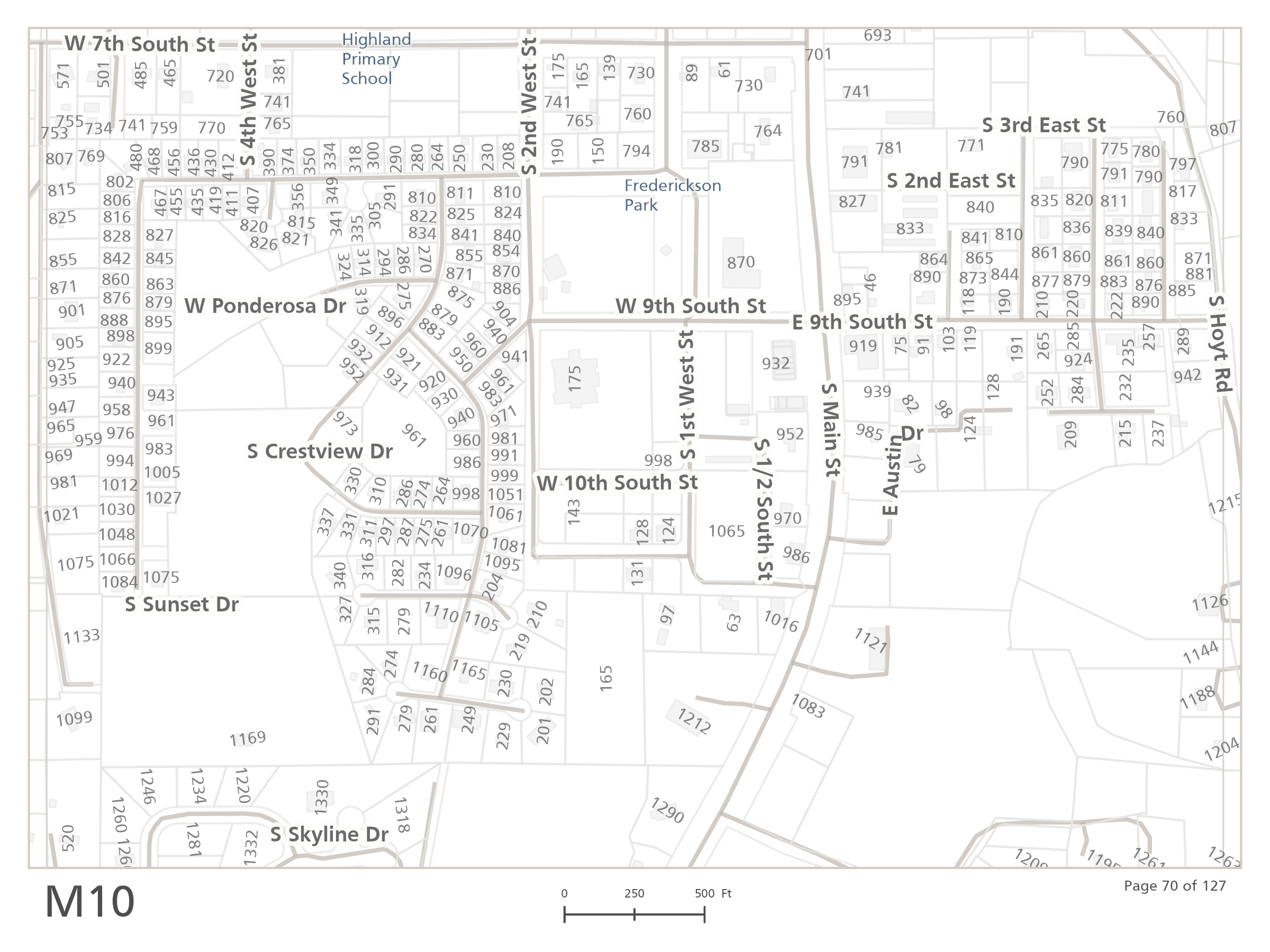
Custom Arcade expressions formatted the labels for print. They corrected numeric ordinals such as 1st, 2nd, and 10th and reduced unit identifiers to compact values by removing words such as “suite,” “unit,” and “apartment.” The goal wasn’t to cram labels onto each page, but to make each address easier to associate with the correct building and street.
Orienting addresses to the street network
Generic point-centered placement kept address numbers horizontal but didn’t account for the direction of the corresponding street, particularly along curved roads and irregular development patterns.
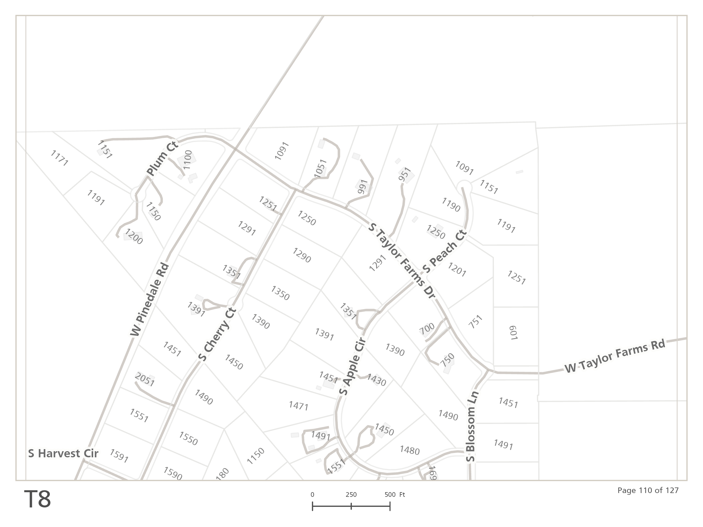
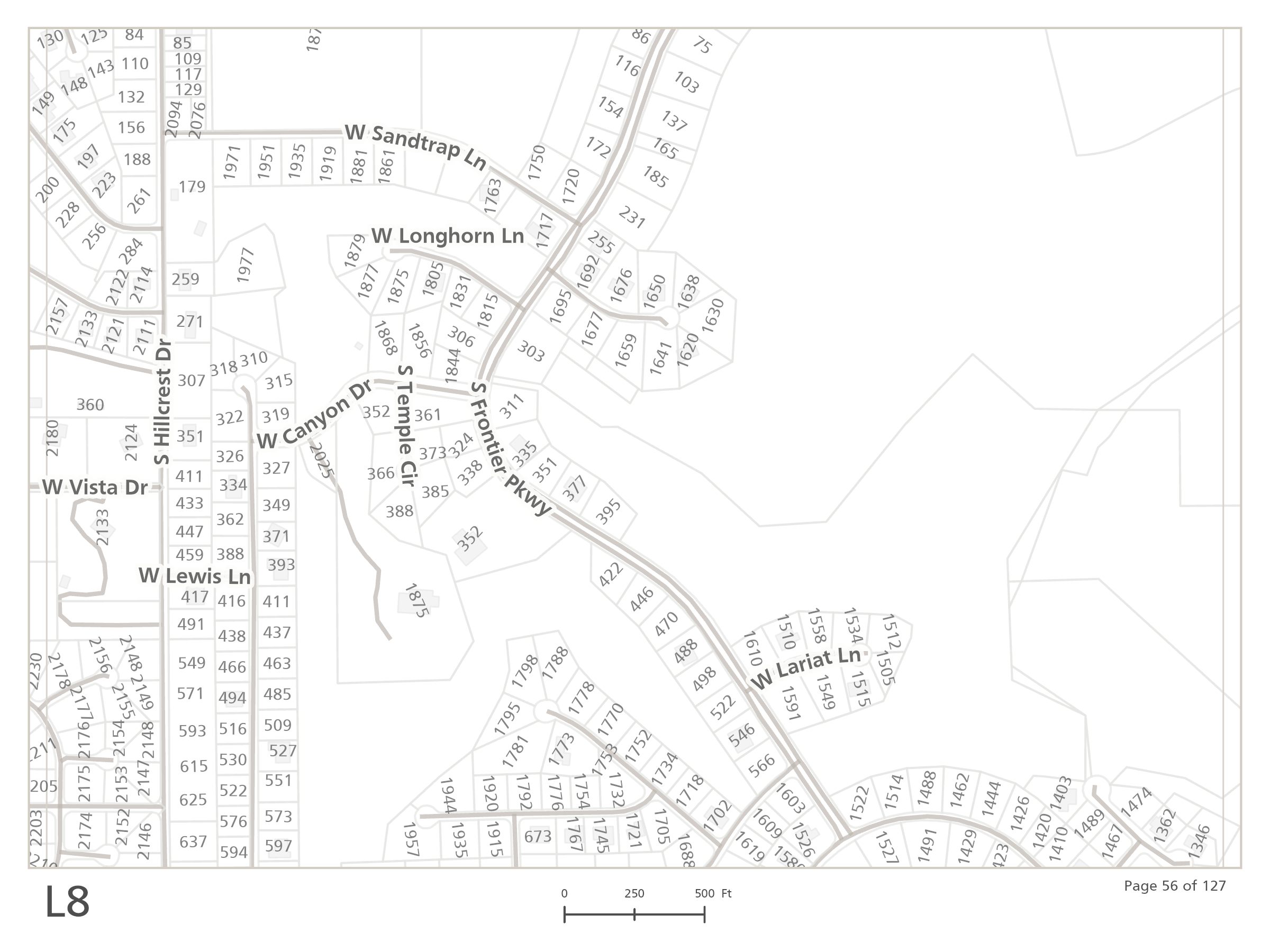
To improve that relationship, the Assign Streets to Points tool in ArcGIS Pro was used to associate each address point with the appropriate road segment and carry the segment’s bearing into the address layer. The address labels could then be placed perpendicular to the assigned street while remaining upright for readability.


The change is subtle, but across a dense printed series it reduces ambiguity and makes each page faster to scan.
Building the page grid and street index
The final map book used a grid-based map series at a consistent scale of 1 inch to 400 feet, or 1:4,800. Each page covered a fixed ground area, while the overview displayed the corresponding labeled grid cells. This provided two ways to navigate the series: visually from the overview or alphabetically through the accompanying street index.
To build the street index, grid page identifiers were spatially joined to the road network. Address ranges and page associations were then exported and formatted as an alphabetized table. The overview, map-series pages, and street index were combined into a single print-ready PDF.
Draft pages were printed at their intended size to evaluate address coverage, label legibility, map scale, and page organization. The layouts were then revised in response to the physical review and client feedback.

Designed for field use
Producing this map book required a different approach to cartographic design. The final product wasn’t intended to be explored on a monitor; it had to remain readable on a printed page, be navigable without a search bar, and communicate location quickly.
Fixed scale, street-oriented address labels, consistent page identifiers, and the accompanying street index turned several operational datasets into a practical field reference. Test prints and client feedback were not cosmetic finishing steps. They were part of verifying that the design worked at the size and in the setting for which it was intended.
Categories: Mapping, Spatial data management