Global Navigation Satellite System (GNSS) receivers use satellite signals to calculate locations in the field. Mapping-grade and survey-grade receivers are designed to support different levels of positional accuracy.
At seven survey control monuments across northern Albuquerque, positions from both receiver classes were compared with the City of Albuquerque’s published coordinates. The resulting maps make the difference visible at each location: mapping-grade offsets of 6.6 to 14.1 feet alongside survey-grade offsets of 0.6 to 0.7 feet.
Field collection and comparison
Published coordinates and monument descriptions from the City of Albuquerque survey control dataset were used to locate the seven reference monuments. Mapping-grade positions, attributes, and photographs were collected with a Trimble TDC100 handheld GNSS receiver and MapIt. Survey-grade positions collected separately with a Carlson BRx6 receiver were then provided for comparison.

In ArcGIS Pro, the Measure Direction Distance tool was used to determine the distance and bearing from each published coordinate to the corresponding mapping-grade and survey-grade position.
Monument-by-monument comparison
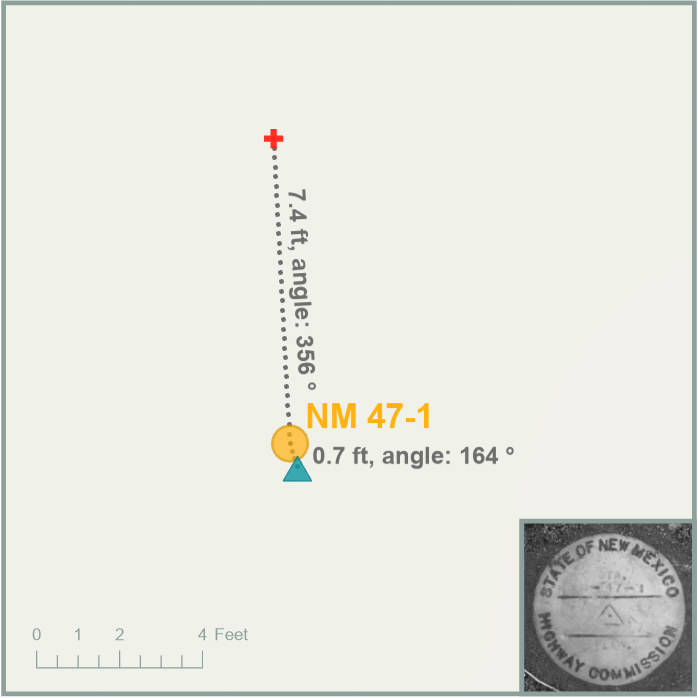
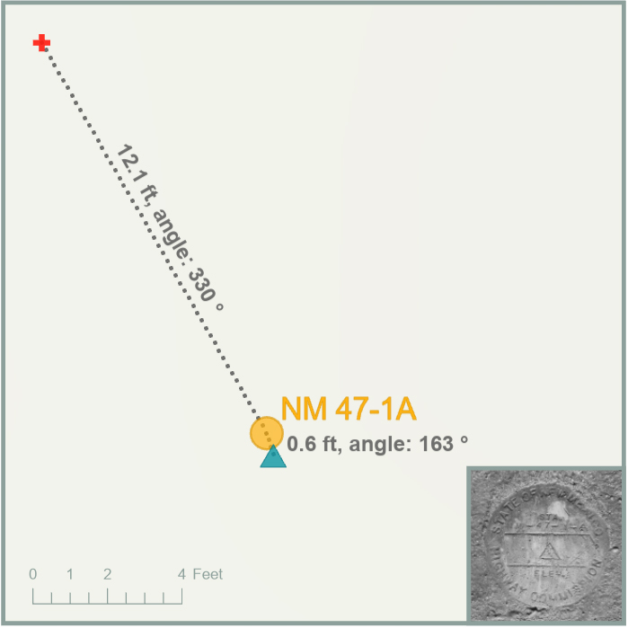
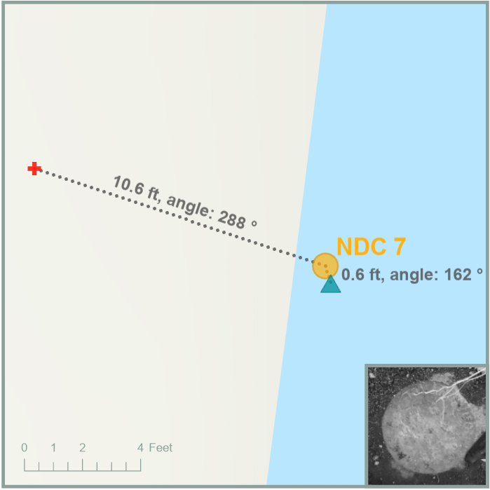
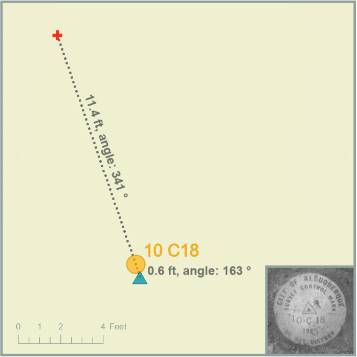
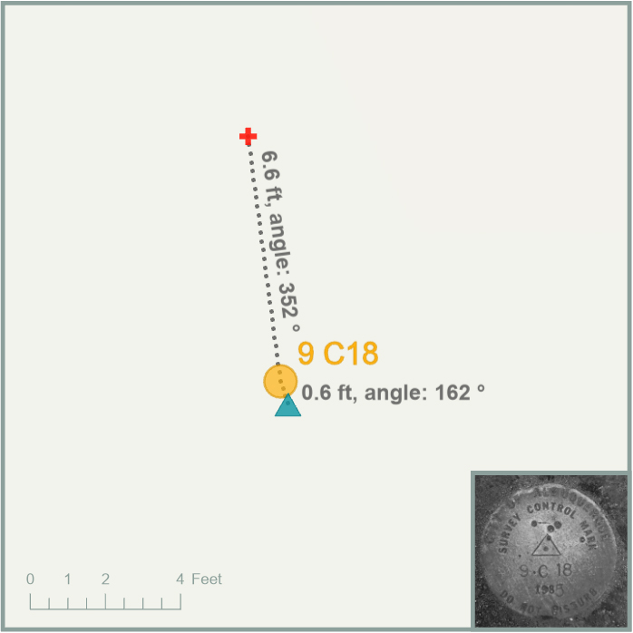
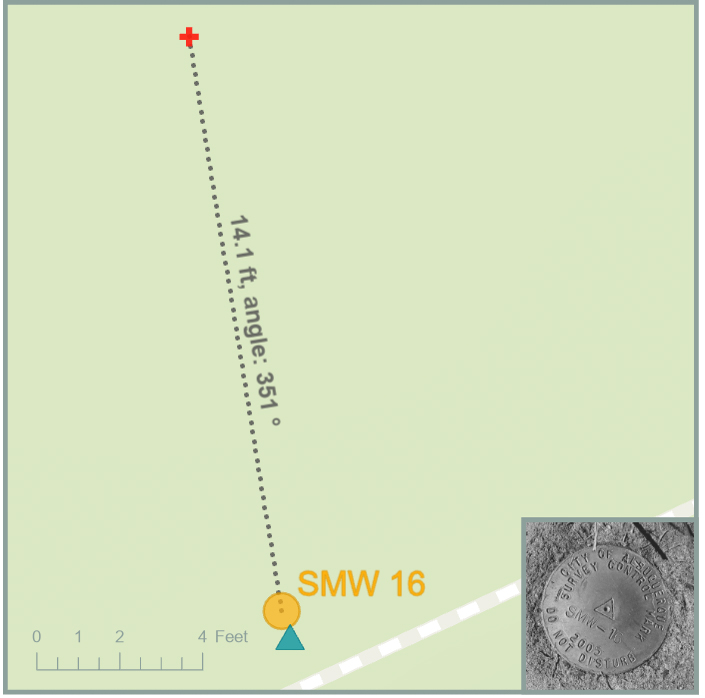
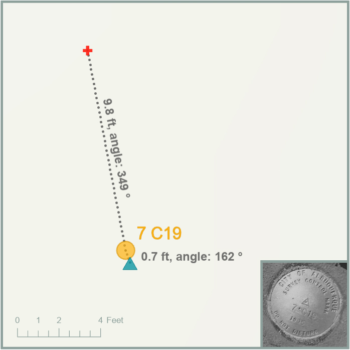
The overview map establishes geographic context, but the positional differences only become readable at a much larger scale. Each detailed view below shows the published coordinate, the two GNSS observations, the measured offset lines, and a photograph of the monument. The red cross identifies the mapping-grade position, the yellow circle the published coordinate, and the teal triangle the survey-grade position; dotted lines report offset distance and direction.
Results and interpretation
The mapping-grade positions ranged from 6.6 to 14.1 feet from the published coordinates, with a mean offset of 10.3 feet. All seven were displaced northwest of their corresponding published coordinates. The survey-grade positions ranged from 0.6 to 0.7 feet away, averaging 0.64 feet, and all seven fell southeast of the published coordinates.

The directional consistency within both sets is notable and suggests some systematic influence, but the available project records do not identify its source. Collection conditions, receiver configuration, correction methods, or coordinate handling may have contributed; the maps document the pattern without establishing a definitive cause.
Because only one position from each source was compared at each monument, the results support a comparison of positional accuracy, not precision or repeatability.
In this comparison, the survey-grade observations aligned much more closely with the published coordinates. The results illustrate why expected positional tolerance should guide equipment choices: mapping-grade equipment may be adequate for general asset inventory, while work requiring sub-foot positioning depends on a higher-accuracy receiver and an appropriate collection and correction workflow.

Categories: Mapping, Spatial analysis, Field operations