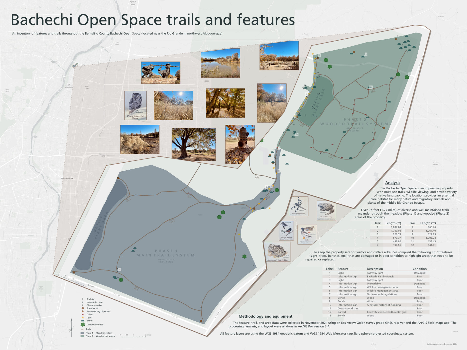
A useful open-space inventory accounts for more than trails. At Bachechi Open Space near the Rio Grande in northwest Albuquerque, field mapping documented the trail network alongside signs, benches, lights, waste facilities, culverts, native plant areas, and large cottonwoods. Recording the condition of individual assets added a practical maintenance layer, showing both what was present and what might need attention.
Building the field inventory
The field inventory began with a feature-service data model designed in ArcGIS Online to organize the different feature types and capture useful attributes for each. Field observations were collected in November 2024 with ArcGIS Field Maps, with positions recorded using either an Eos Arrow Gold+ GNSS receiver or the iPhone 12 Pro’s integrated GNSS.
The field data were then processed in ArcGIS Pro to construct the trail and area features, calculate their measurements, and prepare the final map. The completed inventory included more than 9,000 feet (1.77 miles) of trails across the meadow and wooded portions of the property.
Using the inventory to identify maintenance needs
The condition records were used to distinguish assets documented as damaged or in poor condition from the broader site inventory. The final layout pairs the complete inventory with a focused table of those features, making potential maintenance needs easier to locate and review.
Categories: Mapping, Spatial data management, Field operations