Designing and producing a printed map book to support emergency response operations in adjacent towns in Arizona.
The map series was designed to support first responders with fast, reliable access to street-level and address-level information. The PDF was optimized for field use and high-quality printing, combining consistent cartographic design with careful data preparation to handle dense address labeling and varied urban patterns.
The primary goals of the project were to:
- Create a clear, readable street index and map series suitable for emergency response
- Optimize address and road labeling for dense residential areas
- Maintain cartographic consistency across overview, index, and map series pages
- Ensure the final product was print-optimized, not just screen-friendly

Data preparation & structure
The project relied on multiple hosted feature services, including roads, parcels, address points, and points of interest.
Because source data could not be edited directly, all transformations were handled through temporary layers, spatial joins, and derived fields.
Labeling strategy
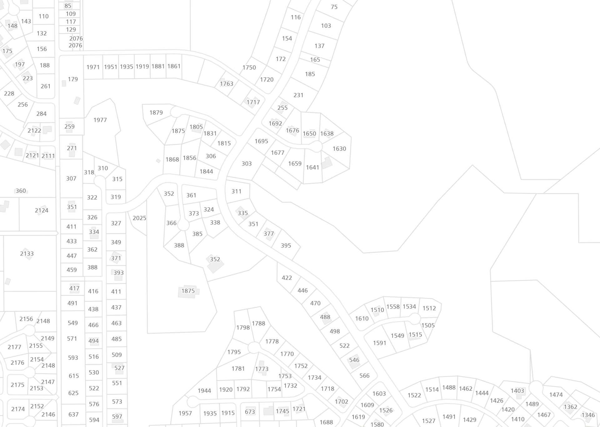
Labeling was the most technically demanding aspect of the project.
Custom Arcade expressions were used to display address numbers, correct ordinal casing (e.g., 1st, 2nd, 10th), and normalize unit identifiers (removing “suite,” “unit,” “apartment,” etc.).
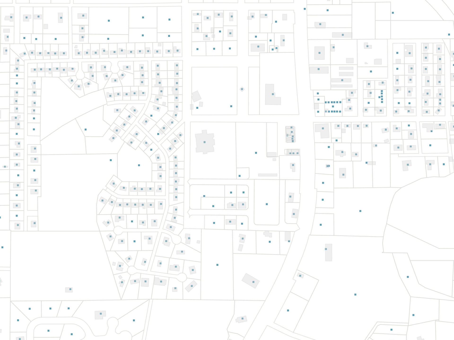
Street-aware address number orientation
To improve both label accuracy and legibility, the Assign Streets to Points geoprocessing tool in ArcGIS Pro was used to associate each address point with its corresponding street segment. This step ensured that address data inherited the correct street attributes while also enabling label orientation based on the street’s bearing.
The resulting street-assigned address layers were then used to align address number labels perpendicular to the street centerline, with labels kept upright for readability.
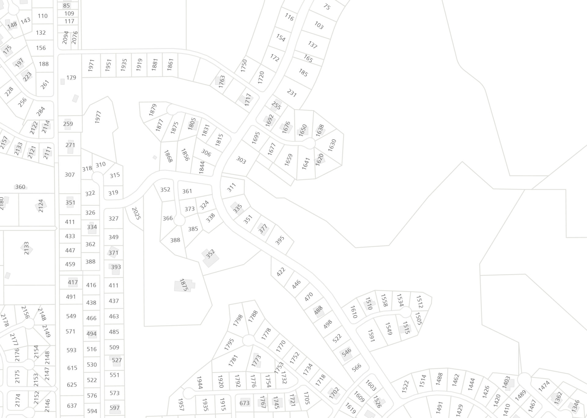
This approach produces a cleaner, more intuitive map by visually reinforcing the spatial relationship between address points and the road network, rather than relying on generic label placement.
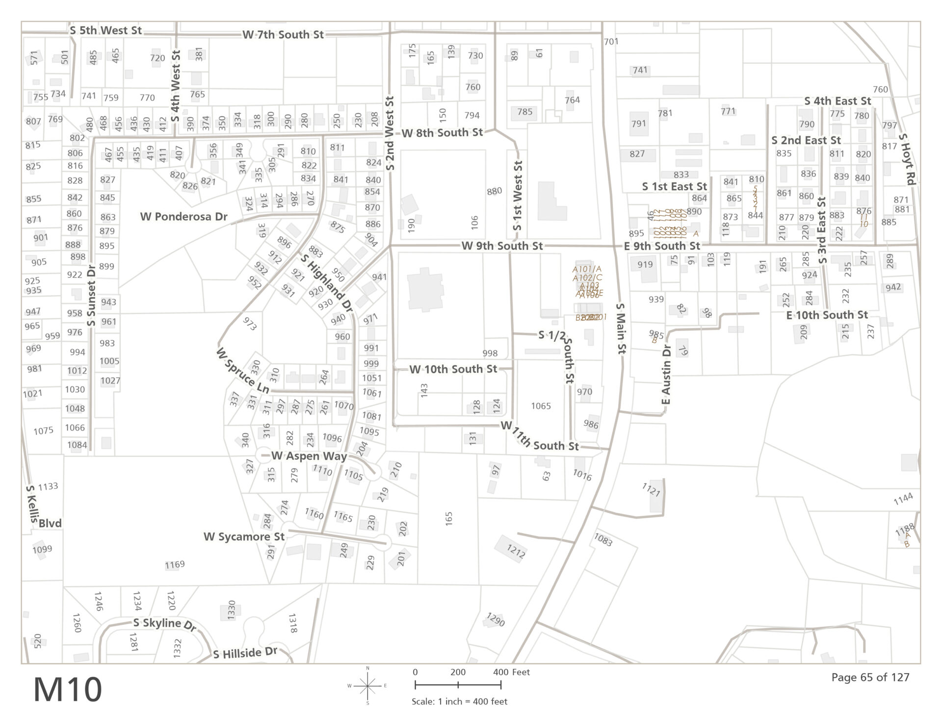
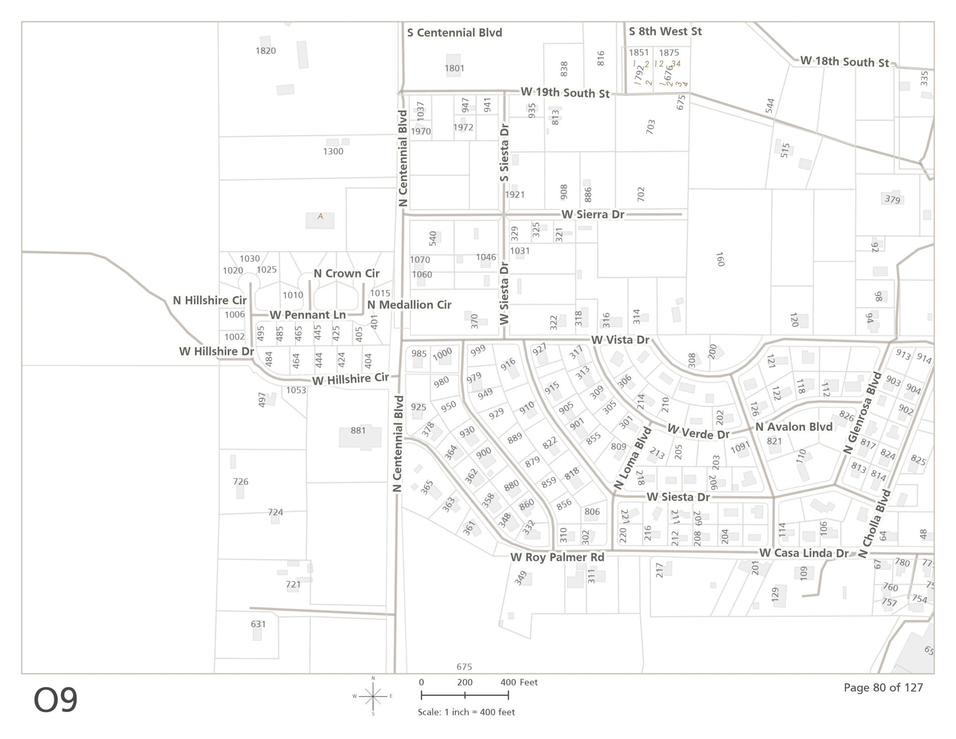
Map series & index design
The final map book is organized around a grid-based map series, with each page covering a fixed ground area at a consistent scale chosen to balance coverage and legibility (1″ on the map equals 400′ on the ground). A corresponding overview page provides a visual index of grid extents, allowing users to quickly identify the appropriate map page during time-sensitive situations.
To support rapid lookup by street name, grid page identifiers were spatially joined to the road network and exported to a tabular format. Address ranges were then calculated and formatted in a spreadsheet environment (Excel), producing a clean street index that could be reintegrated with the map layouts as a single, print-ready document.
Throughout the process, intermediate outputs were reviewed to verify address coverage, label visibility, and page extent consistency across the series.
The completed map book provides emergency responders with a clear, consistent spatial reference designed specifically for field use.