Where are the most suitable locations for new mobile library stops to serve rural communities in West Virginia?
Many rural areas in West Virginia have limited or no access to fixed library facilities, contributing to disparities in access to information, education, and literacy resources. Mobile libraries (bookmobiles) offer a flexible, community-centered solution, but identifying optimal stop locations requires careful spatial planning.
This project compared two vector-based map overlay techniques, Boolean and Weighted Linear Combination (WLC), to locate suitable mobile library stops that balance community need with logistical feasibility.
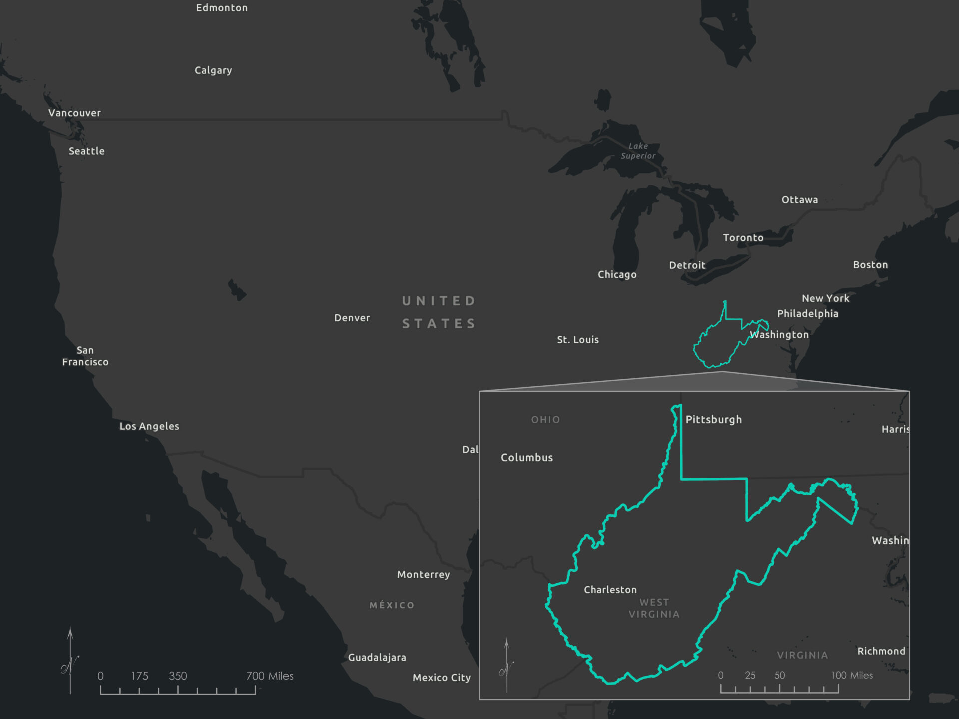
Study Area
The study area included rural census block groups across West Virginia, particularly in Appalachian regions with low population density and limited infrastructure. The terrain, sparse road networks, and socioeconomic variation make accessibility a key challenge.
Criteria and data sources
The criteria below were selected to reflect both need and logistical feasibility for mobile library service across West Virginia. Each dataset supported a specific spatial condition used in the Boolean and weighted suitability models.
| Criterion | Purpose | Data source |
|---|---|---|
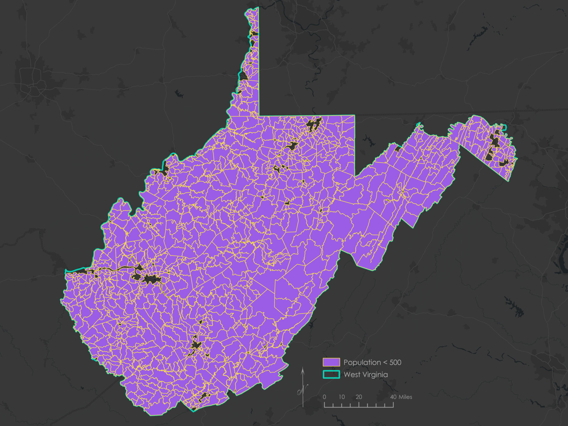
| Population < 500 people per square mile | Focus analysis on rural areas with limited fixed library access and lower density | USA 2020 Census Population Characteristics |
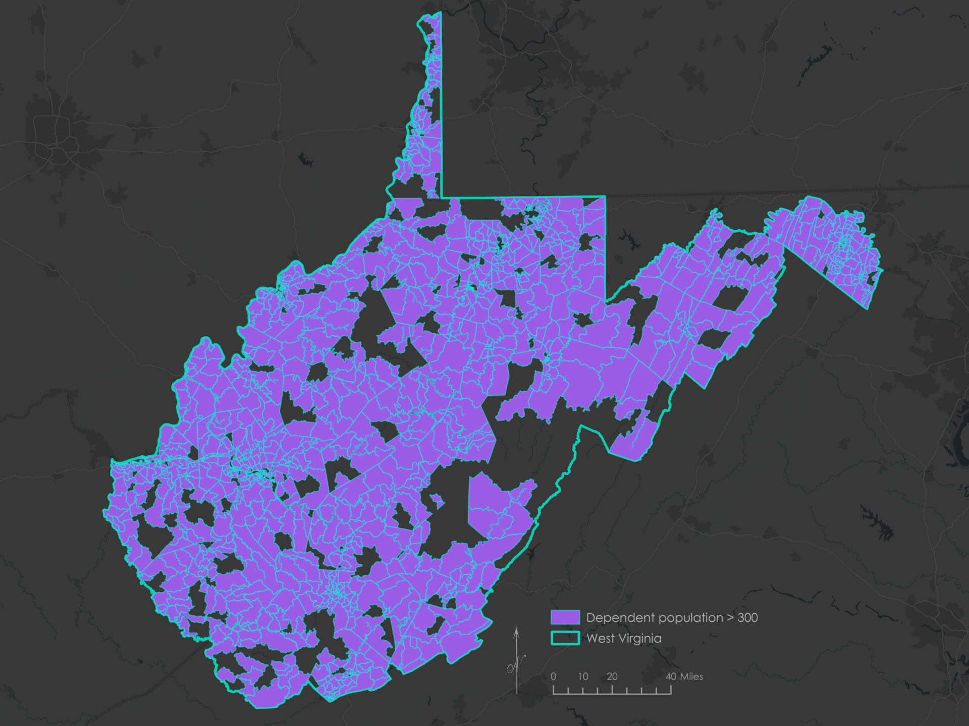
| Population under 18 or over 65 > 300 | Prioritize locations serving youth and seniors who benefit from mobile services | USA 2020 Census Population Characteristics |
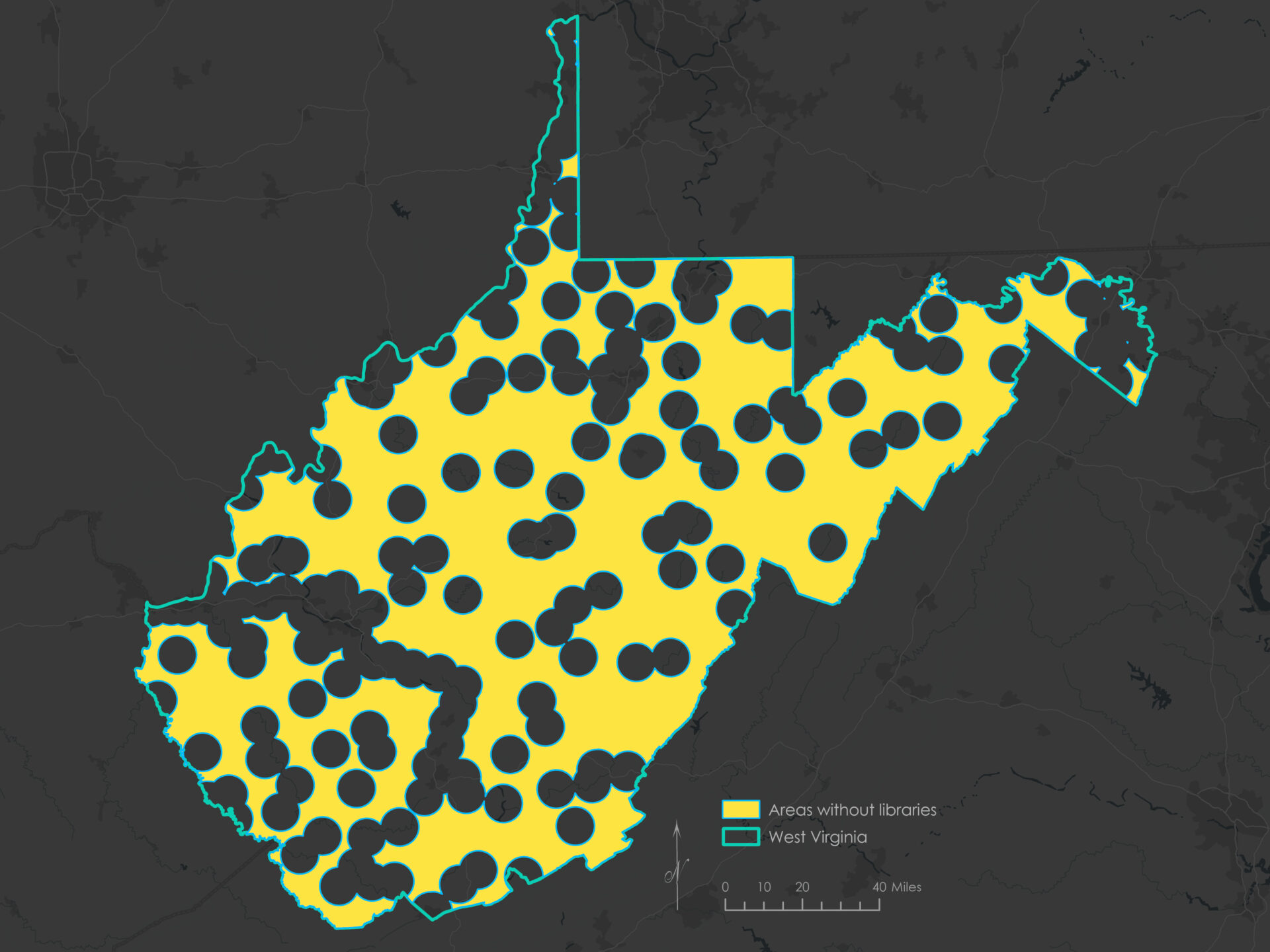
| More than 5 miles from existing libraries | Avoid redundancy by targeting areas outside existing service coverage | Libraries |
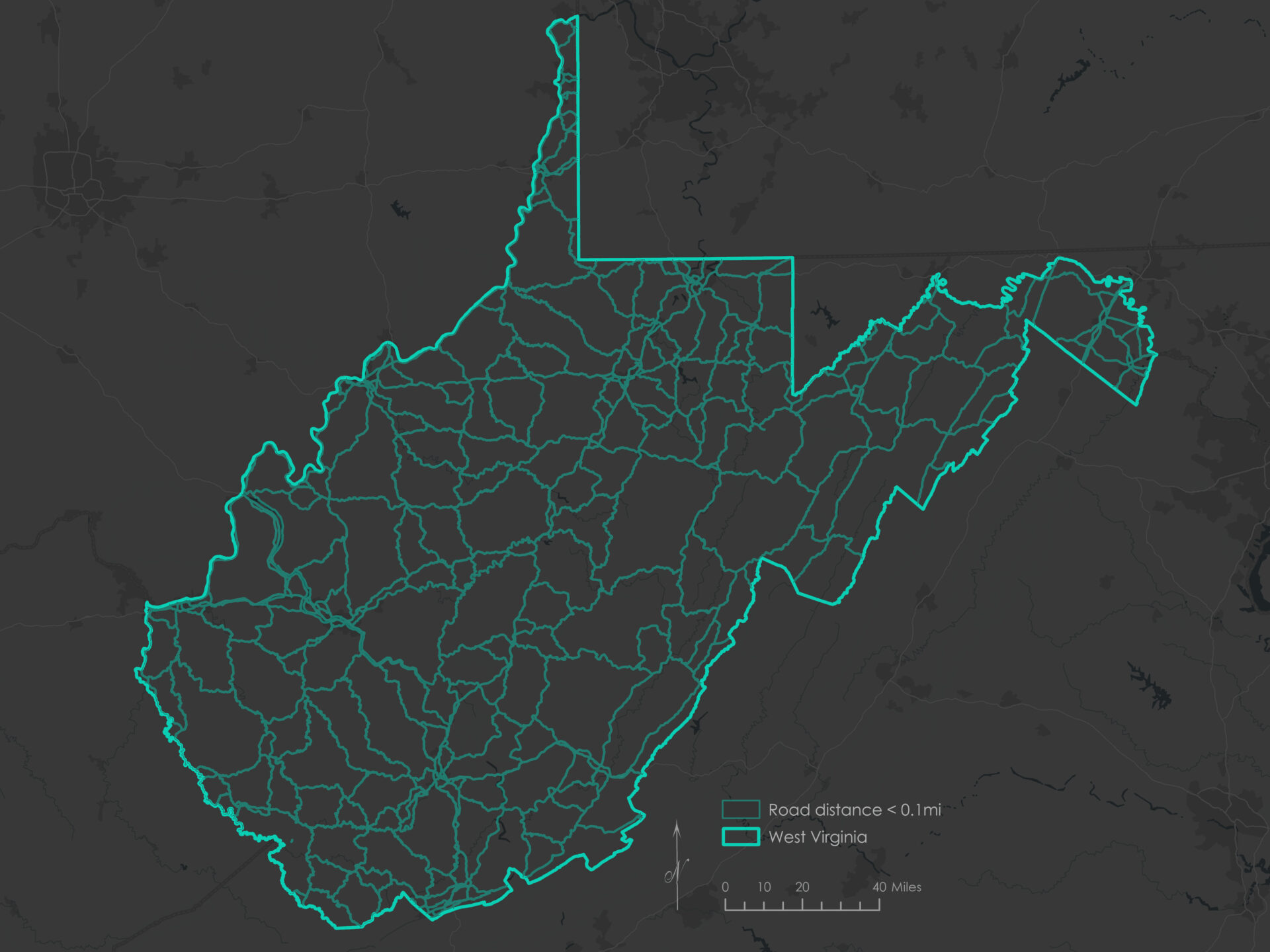
| Within 0.1 mile of major roads | Ensure bookmobiles can access selected sites safely and efficiently | 2024 TIGER/Line Shapefiles: Roads |
| Within 1 mile of schools | Leverage schools as community hubs to reach students effectively | Schools K-12 |
All spatial data were downloaded in July 2025, clipped to the area of West Virginia (from the USA Census States feature service), and projected to NAD 1983 StatePlane West Virginia FIPS 4702 (Feet) prior to analysis.
The West Virginia State Plane coordinate system preserves distance and area, and uses a Lambert Conformal Conic projection, which is appropriate for states that are wider east–west than north–south.
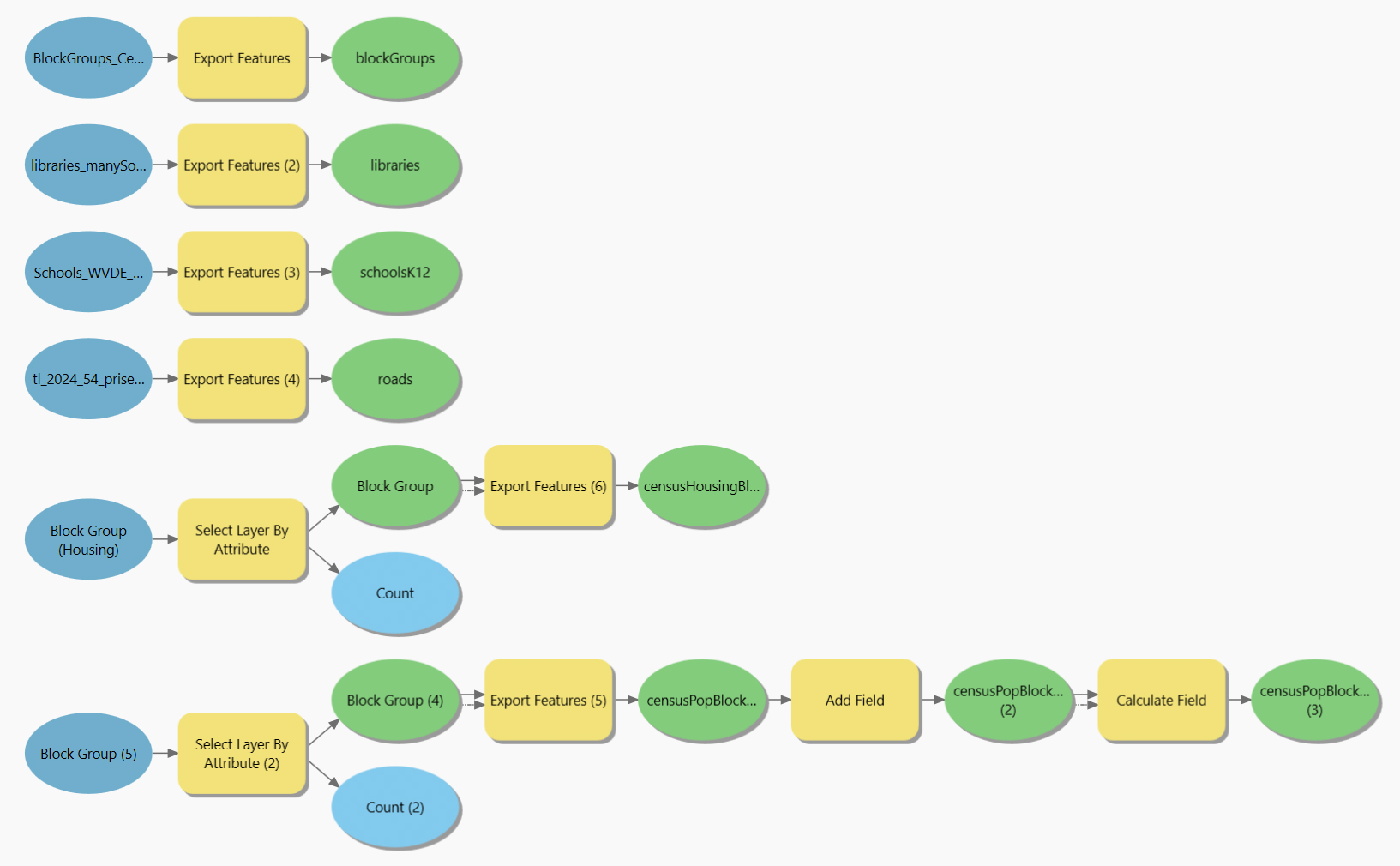
Boolean suitability analysis
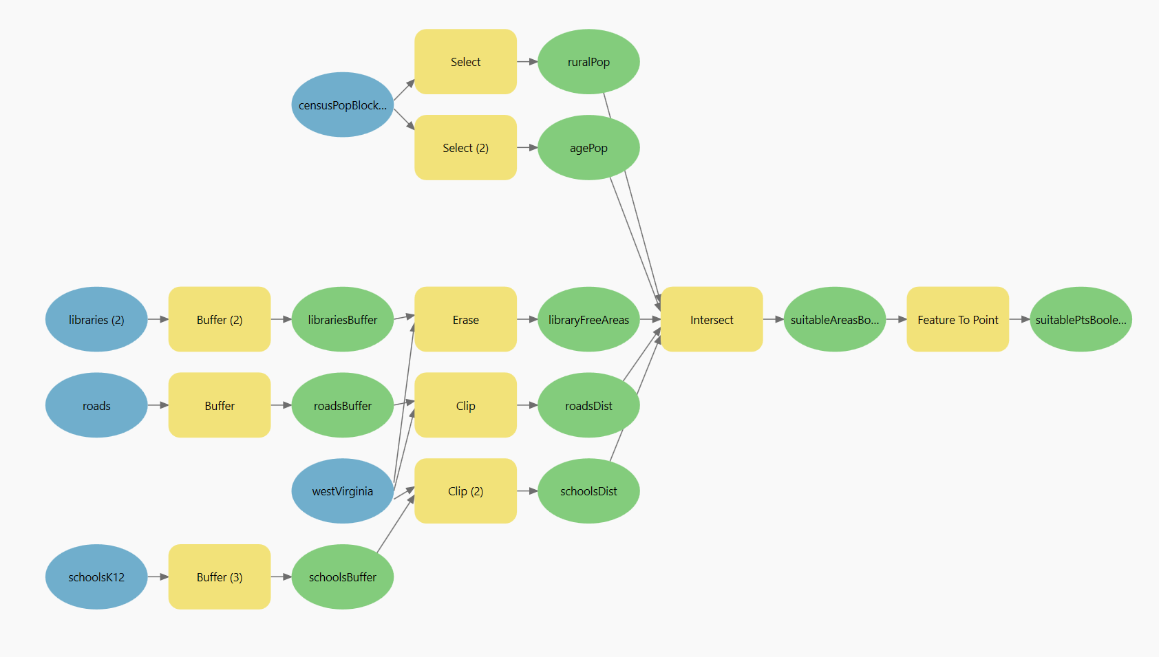
Boolean suitability analysis applies a series of spatial filters to isolate locations that meet all required conditions. Each input dataset was processed using threshold rules that convert features into binary “suitable” or “not suitable” layers. This model created evaluated the suitability based on the five defined criteria:
- Population density below 500 people per square mile
- Dependent population (under 18 or over 65) greater than 300
- Within 0.1 miles of a road
- More than 5 miles from a fixed library
- Within 1 mile of a K–12 school
These conditions were applied using Select, Buffer, Erase, and Clip tools, then combined with Intersect to identify locations that satisfied all five constraints.
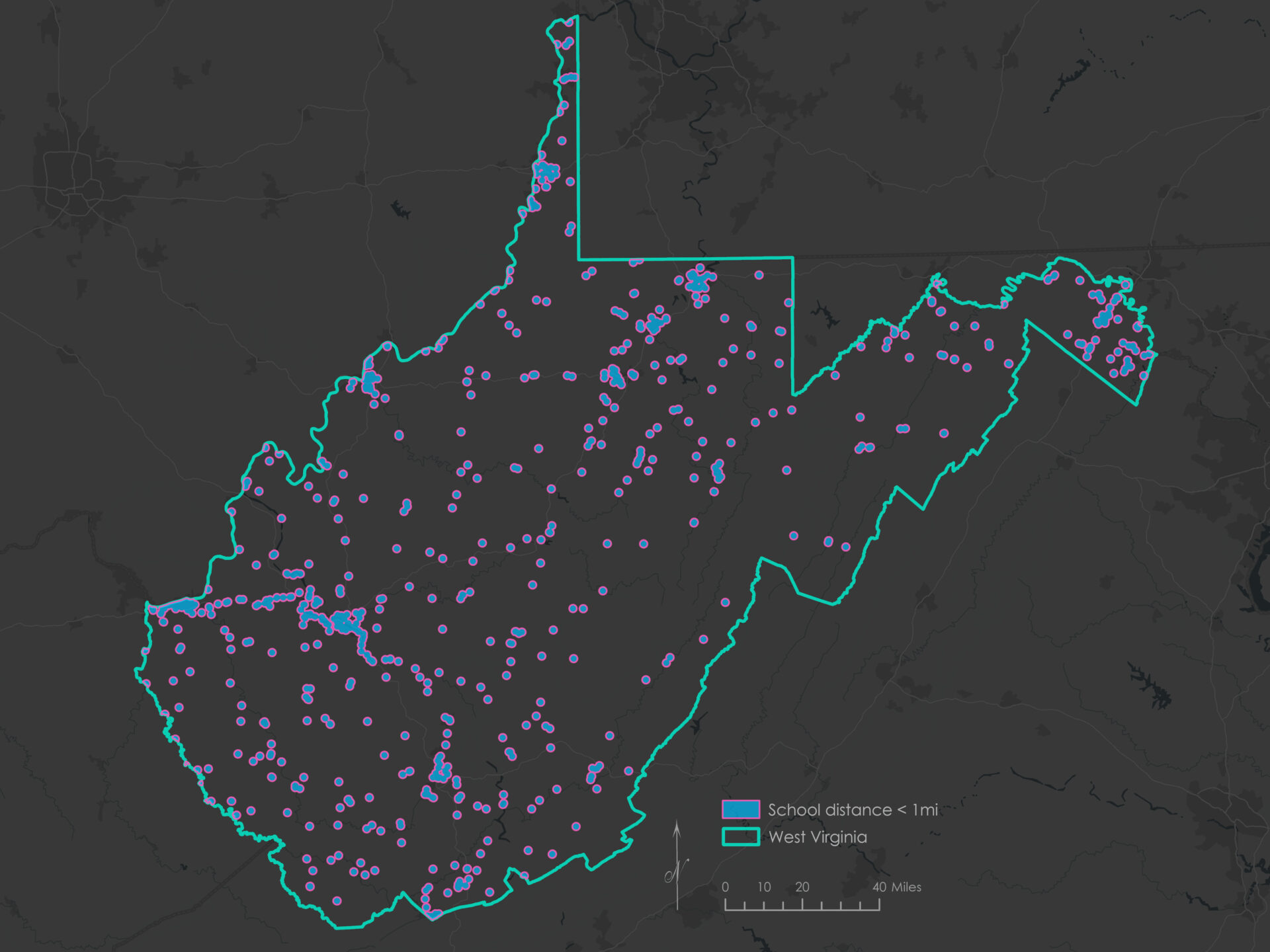
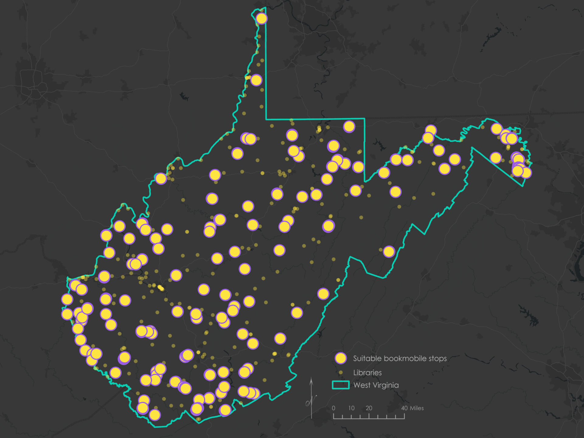
The result represented a conservative estimate of the 168 most logistically feasible and underserved areas for mobile library stops.
Weighted suitability analysis
Weighted Linear Combination (WLC) suitability analysis offers a more flexible, prioritized approach to identifying suitable sites. Instead of requiring all conditions to be met, each criterion can be assigned a ranked score based on how well it meets the desired criteria. Scores are then weighted and combined into a single composite value, allowing more important factors to contribute more heavily to the final result.
For this project, each criterion was standardized to a 1–4 scale based on favorability.
| Score | Suitability |
|---|---|
| 1 | Not suitable |
| 2 | Low suitability |
| 3 | Medium suitability |
| 4 | High suitability |
Since the weighted suitability analysis process is more fluid and flexible, it is helpful to reframe the project criteria to demonstrate the gradients for the ranking. The following table also includes the assigned weights for each criterion (i.e., their relative importance in the analysis model).
| Criterion | Purpose | GIS features | Weight |
|---|---|---|---|
| Farther away from libraries | Avoid redundancy by targeting areas outside existing service coverage | Multi-ring buffer around existing library locations | 0.3 |
| Larger population under the age of 18 or over 65 | Prioritize locations serving youth and seniors who benefit from mobile services | Ranking based on population of people under the age of 18 or over the age of 65 | 0.25 |
| Closer to major roads | Ensure bookmobiles can access selected sites safely and efficiently | Multi-ring buffer around primary and secondary roads | 0.2 |
| Smaller overall population | Focus analysis on rural areas with limited fixed library access and lower density | Ranking based on the total population (broken down by Census block groups) | 0.15 |
| Closer to schools | Leverage schools as community hubs to reach students effectively | Multi-ring buffer around K–12 schools | 0.1 |
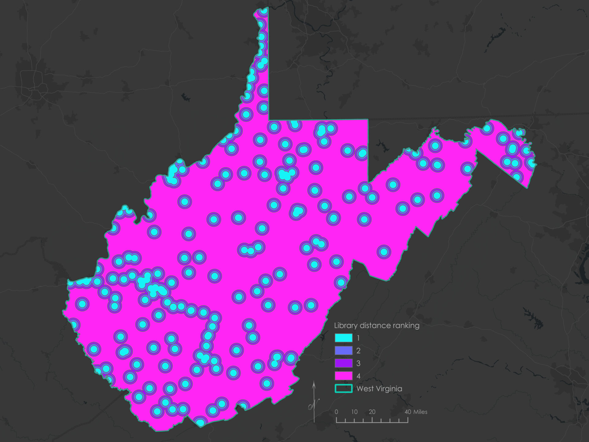
Distance from libraries ranking
Areas located farther away from existing public libraries were considered more suitable for new mobile library stops. This criterion helped identify service gaps where bookmobiles could provide additional access to library resources.
| Score | Distance from libraries | Suitability |
|---|---|---|
| 4 | > 5 miles | High |
| 3 | Between 3–4 miles | Medium |
| 2 | Between 2–3 miles | Low |
| 1 | < 2 miles | Not suitable |
To generate this ranking, I used the Multiple Ring Buffer tool to create 2-, 3-, and 4-mile buffers around library locations. These buffers were merged with the West Virginia boundary using the Union tool, then clipped to the state extent. A new field titled rankLibraries was added to the attribute table and suitability scores were calculated based on the assigned buffer ring.
Here’s the Python code block used to calculate the suitability ranking:
def Reclass(distance):
    if distance == 2:
        return 1
    elif distance == 3:
        return 2
    elif distance == 4:
        return 3
    else: return 4
The above script was entered into the Calculate Field tool using the expression Reclass(!distance!). Distances were interpreted from the ring values, with locations outside the 4-mile buffer receiving the highest score.
Population age ranking
To prioritize locations that serve youth and seniors — groups more likely to benefit from mobile library services — block groups with higher counts of dependent-age residents were given higher suitability scores.
| Score | Buffer groups | Suitability |
|---|---|---|
| 4 | Population (under 18 or over 65) > 300 | High |
| 3 | Population (under 18 or over 65) between 200–299 | Medium |
| 2 | Population (under 18 or over 65) between 100–199 | Low |
| 1 | Population (under 18 or over 65) < 100 | Not suitable |
To calculate these scores, I used the field P012_calc_numDepend, which totals the number of people under 18 or over 65 within each block group. A new field named rankAgePop was added using the Calculate Field tool with the following Python code block:
def Reclass(pop):
    if pop > 300:
        return 4
    elif 200 <= pop <= 300:
        return 3
    elif 100 <= pop < 200:
        return 2
    else:
        return 1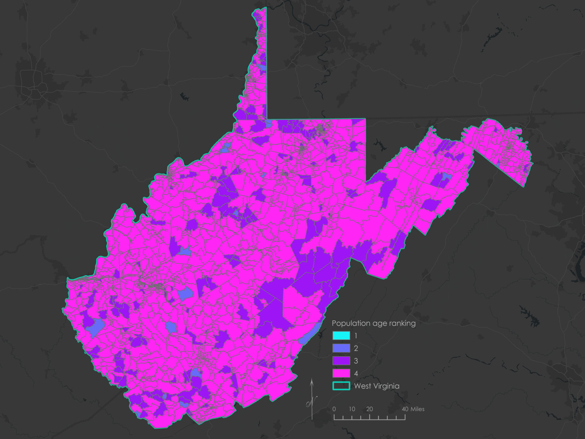
Distance to roads ranking
To ensure ease of access and operational efficiency, locations closer to major roads were considered more suitable for mobile library stops.
| Score | Distance to roads | Suitability |
|---|---|---|
| 4 | < 0.1 mile | High |
| 3 | Between 0.1–0.25 mile | Medium |
| 2 | Between 0.25–0.5 mile | Low |
| 1 | > 0.5 mile | Not suitable |
I used the Multiple Ring Buffer tool to generate 0.1-, 0.25-, and 0.5-mile buffer zones around major roads, based on the TIGER/Line shapefile of primary and secondary roads. After merging these buffers with the state boundary and clipping them to the extent of West Virginia, I added a new field called rankRoads and assigned scores based on each buffer zone.
To reclassify the distance field into suitability scores, I used the Calculate Field tool with the following Python code:
def Reclass(distance):
    if distance <= 0.1:
        return 4
    elif 0.1 < distance <= 0.25:
        return 3
    elif 0.25 < distance <= 0.5:
        return 2
    else:
        return 1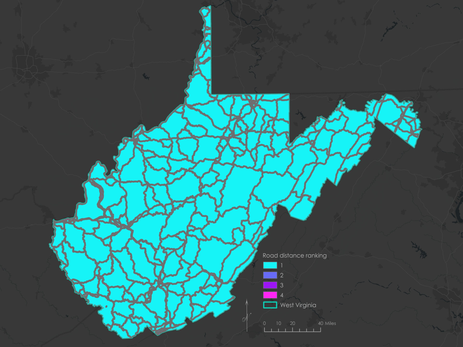
Total population ranking
To generate the total population ranking, I used Census block group data to classify areas by their overall population count. This criterion helped emphasize rural communities with lower populations and limited access to fixed library services.
| Score | Buffer groups | Suitability |
|---|---|---|
| 4 | Population < 500 | High |
| 3 | Population between 500–599 | Medium |
| 2 | Population between 600–699 | Low |
| 1 | Population >= 700 | Not suitable |
Using the Calculate Field tool, I created a new field called rankPop and applied the following Python expression to assign suitability scores based on the !P0010001! field (total population):
def Reclass(pop):
    if pop < 500:
        return 4
    elif 500 <= pop < 600:
        return 3
    elif 600 <= pop < 700:
        return 2
    else:
        return 1
Distance from schools ranking
Areas closer to K–12 schools were prioritized to leverage schools as accessible community hubs where bookmobiles could reach students and families more effectively.
| Score | Distance from schools | Suitability |
|---|---|---|
| 4 | < 0.5 mile | High |
| 3 | Between 0.5–1 mile | Medium |
| 2 | Between 1–2 miles | Low |
| 1 | > 2 miles | Not suitable |
To assign suitability scores, I used the Multiple Ring Buffer tool to generate 0.5-, 1-, and 2-mile buffers around school locations. These buffer zones were merged with the state boundary using the Union tool and clipped to West Virginia. A new field called rankSchools was created to store the reclassified values.
Here’s the Python code block used to rank each buffer zone by suitability:
def Reclass(distance):
    if distance == 0.5:
        return 4
    elif distance == 1:
        return 3
    elif distance == 2:
        return 2
    else: return 1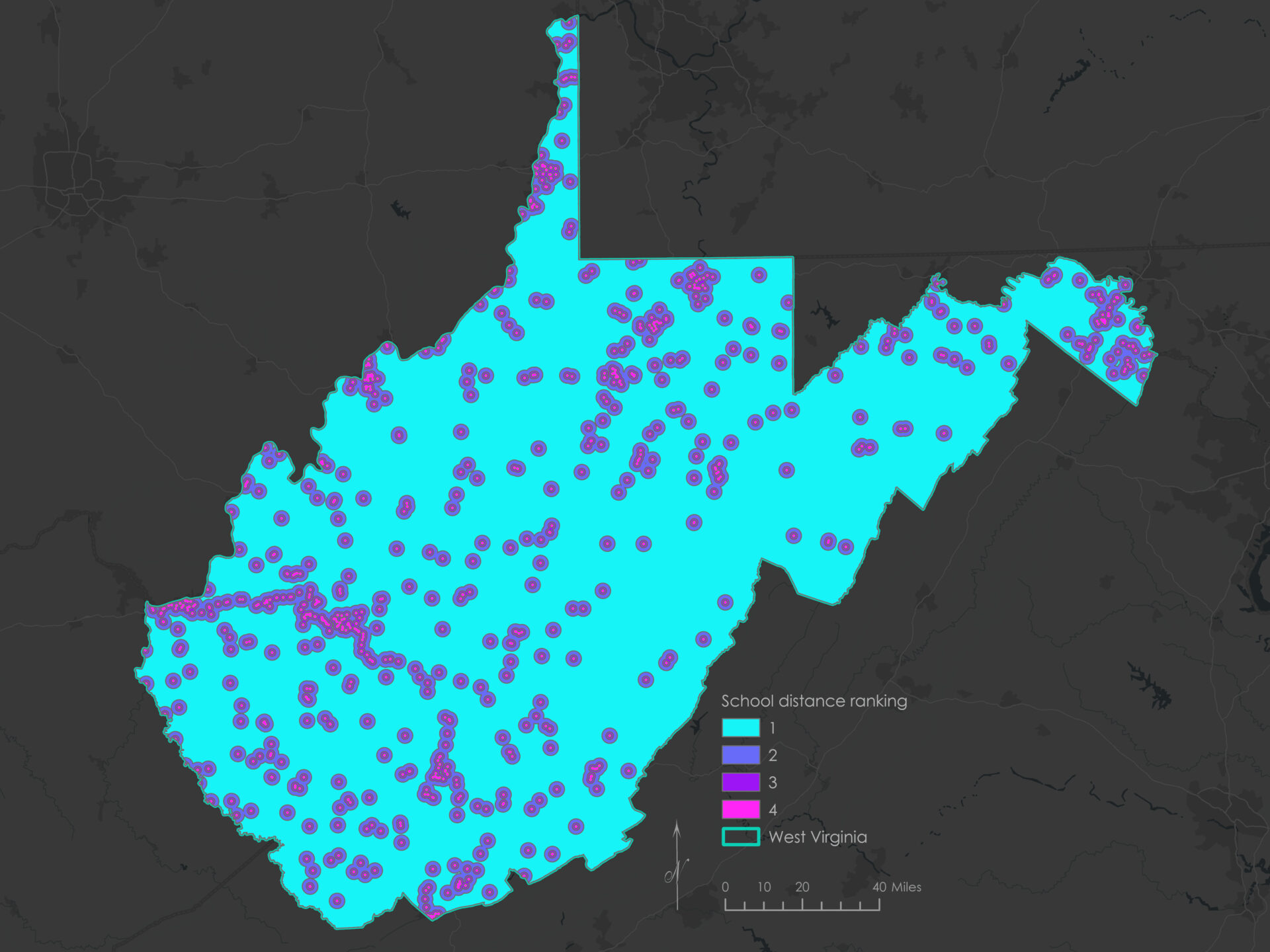
Weight and combine scores
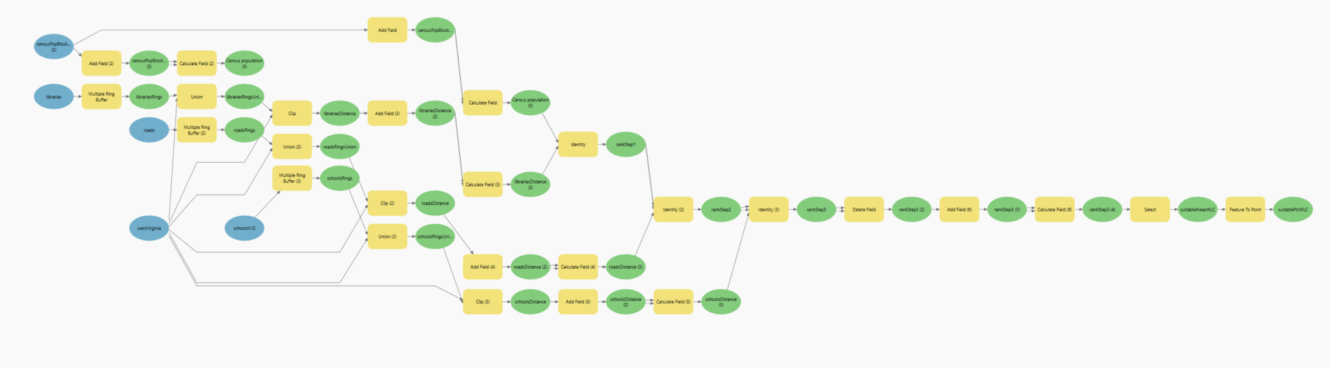
After reclassifying the ranking layers, I combined them using an iterative process using the Identity tool. The output feature class was processed to clean the attribute table.
To determine suitable scores, I added a new field and used the Calculate Field tool to calculate the final weighted suitability scores for the whole study area:
(0.3 * !rankLibraries!) + (0.25 * !rankAgePop!) + (0.2 * !rankRoads!) + (0.15 * !rankPop!) + (0.1 * !rankSchools!)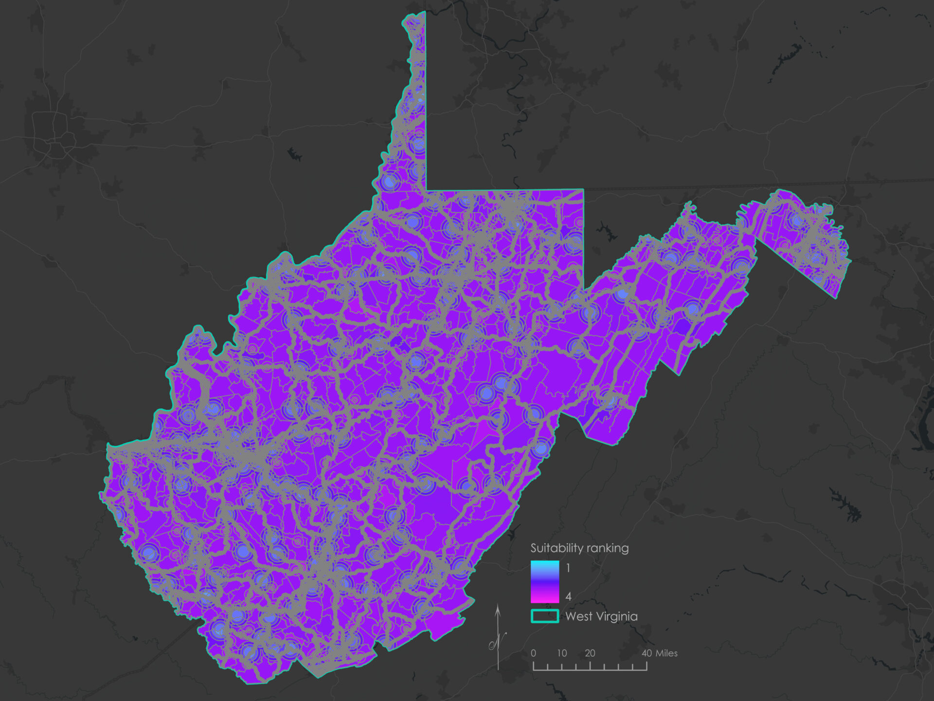
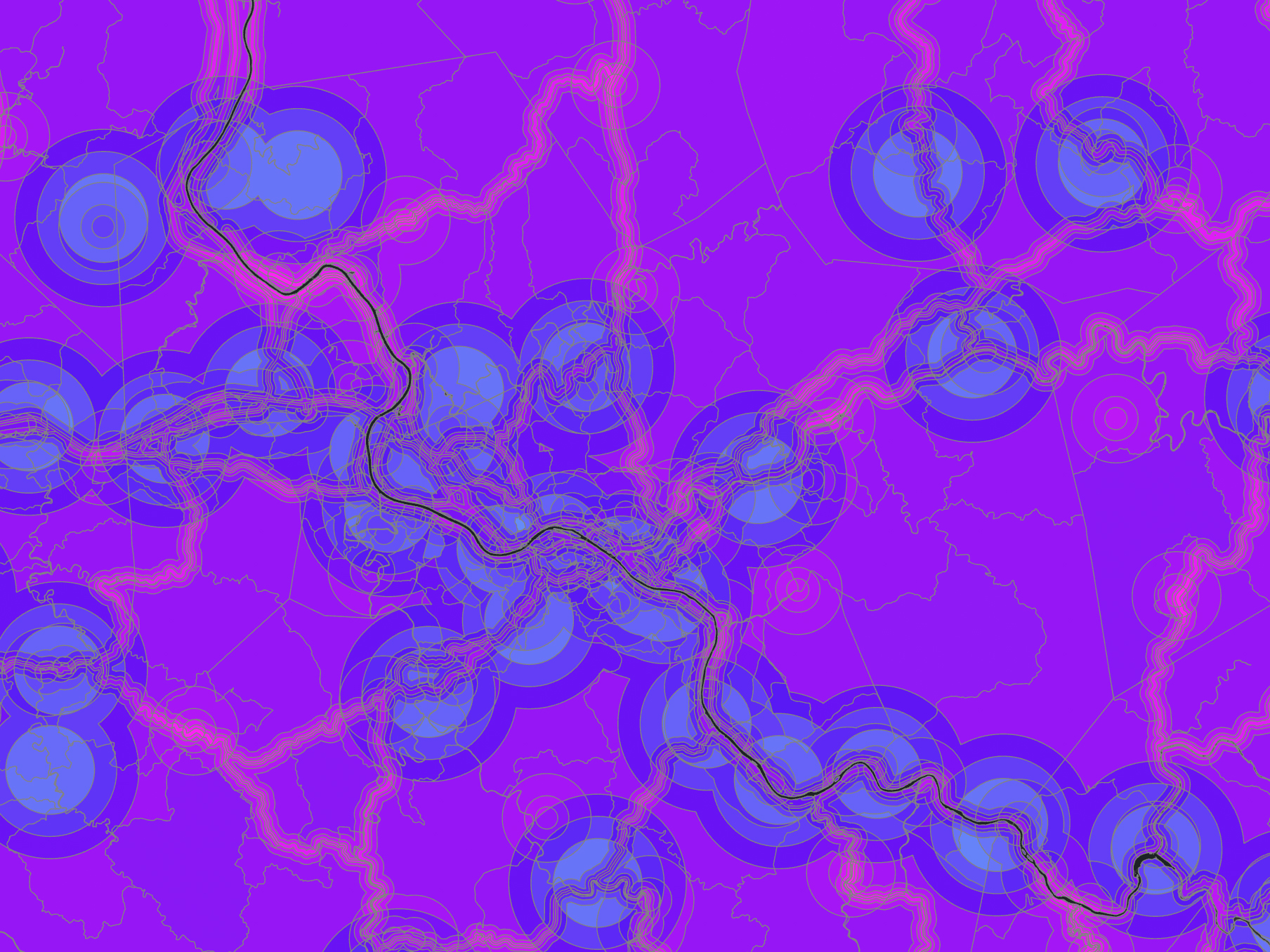
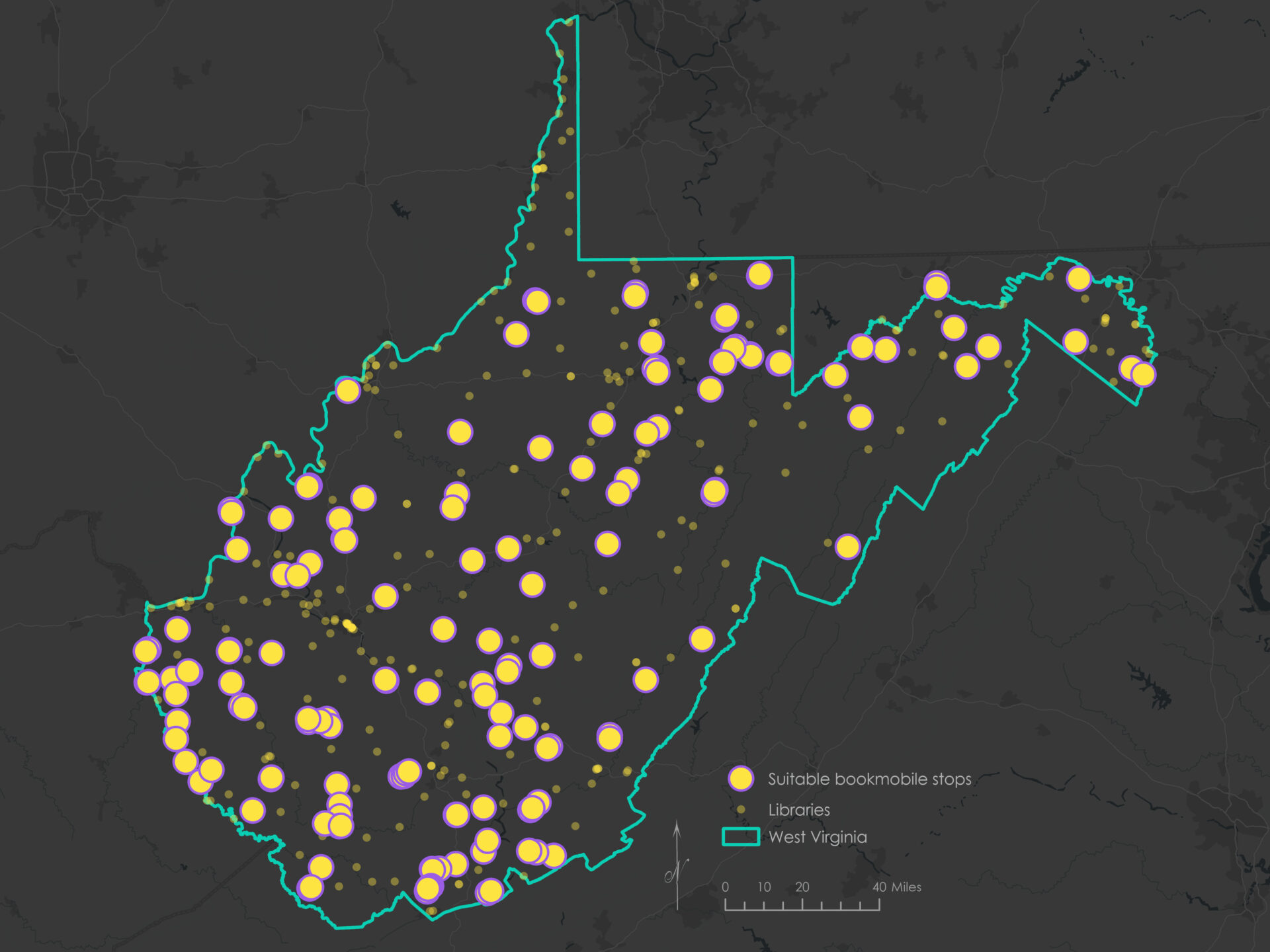
Finally, I extracted areas with a score of 3.5 or greater to identify highly suitable areas, which resulted in 218 suitable areas. I converted those to points for ease of comparison and visualization.
Conclusions
This project demonstrated how Boolean and Weighted Linear Combination (WLC) techniques can be used to identify potential mobile library stop locations in rural West Virginia. The Boolean method produced 168 suitable areas, while the WLC technique yielded 218. Of those, 152 areas were shared by both methods (an 82% overlap with the Boolean result and a 70% overlap with the WLC result).
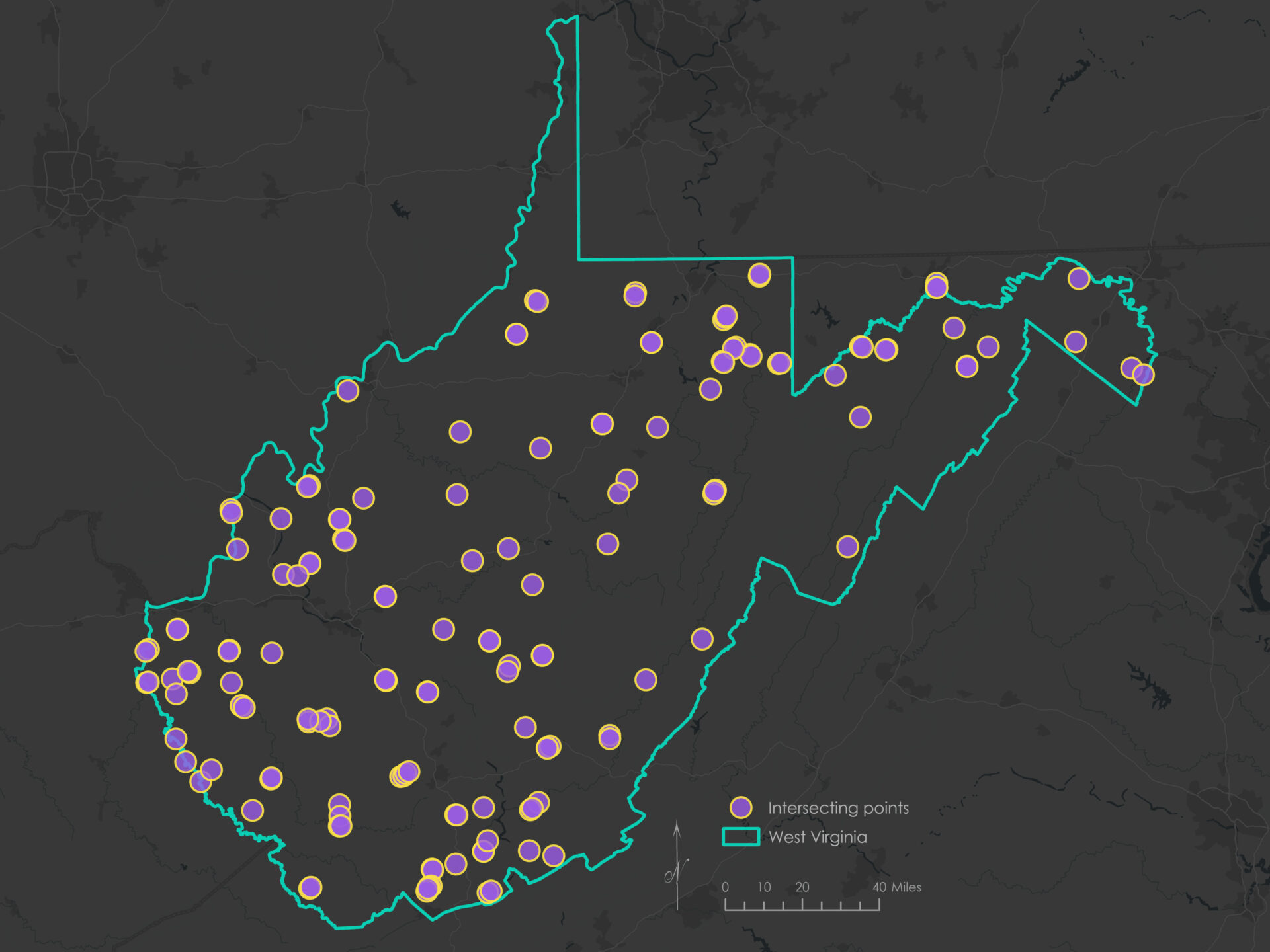
These patterns suggest strong agreement between methods while also highlighting the added nuance and flexibility of the weighted approach. Several areas resulted in clustered points, which could be collapsed into a single stop (centroid or through other means).
A key limitation of this analysis was the reliance on 2020 Census data. Recent shifts in population or infrastructure may not be reflected in the results. Future work could incorporate more current data sources to refine site selection. Additionally, access to road network datasets would be a valuable supplement for performing route analysis and determining optimal driving paths.
Software and tools
This analysis was conducted using ArcGIS Pro 3.5.2. All spatial data were downloaded in July 2025 and projected to NAD 1983 StatePlane West Virginia FIPS 4702 (Feet) prior to analysis.
Citations
U.S. Census Bureau. TIGER/Line Shapefiles: Roads (2024) [Data set]. https://www.census.gov/cgi-bin/geo/shapefiles/index.php?year=2024&layergroup=Roads.
U.S. Census Bureau. USA 2020 Census Population Characteristics [Data set]. https://www.arcgis.com/home/item.html?id=ebeb65deb5c14f4d8849fd68944b7ee6.
U.S. Census Bureau. USA States (Census) [Data set]. https://www.arcgis.com/home/item.html?id=774019f31f8549c39b5c72f149bbe74e.
West Virginia GIS Technical Center. K–12 Public Schools, West Virginia [Data set]. https://wvgis.wvu.edu/data/dataset.php?ID=503.
West Virginia GIS Technical Center. West Virginia Public Libraries [Data set]. https://wvgis.wvu.edu/data/dataset.php?ID=174.